File:Rannersdorf Grundriss LBK Sauer und Schwarzäugl 2006, 19.jpg
Size of this preview: 466 × 599 pixels. Other resolutions: 187 × 240 pixels | 373 × 480 pixels | 700 × 900 pixels.
Original file (700 × 900 pixels, file size: 196 KB, MIME type: image/jpeg)
Captions
Captions
Add a one-line explanation of what this file represents
Summary
edit
| Description |
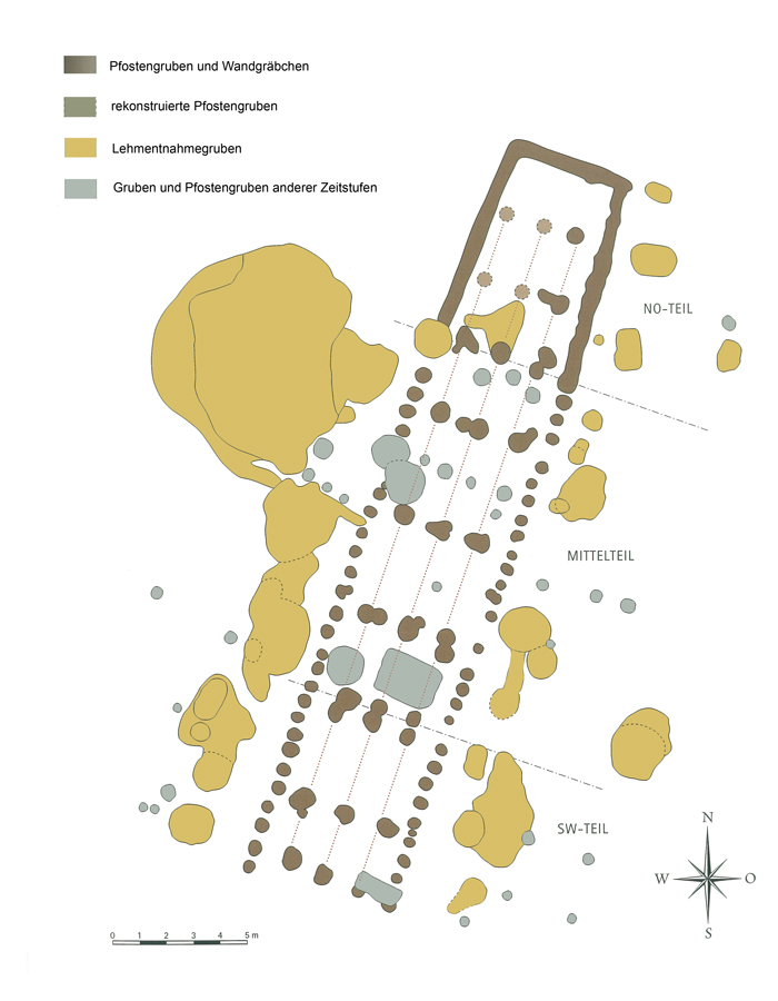
Deutsch: Linearbandkeramischer Hausgrundriss aus Rannersdorf,
archäologische Großgrabung 2001/2002. |
| Date | |
| Source | Das Langhaus des älteren Neolithikums. In: Franz Sauer (Hrsg.) Fundstelle Rannersdorf. Die archäologischen Grabungen auf der Trasse der S1. Grasl Druck & Neue Medien, Bad Vöslau 2006, S. 19 |
| Author | Franz Sauer und Judith Schwarzäugl |
| Object location | | View this and other nearby images on: OpenStreetMap |
|---|
Licensing
edit
This image is in the public domain according to Austrian copyright law because it is part of a law, ordinance or official decree issued by an Austrian federal or state authority, or because it is of predominantly official use. (§7 UrhG)
To uploader: Please provide where the image was first published and who created it.
|
File history
Click on a date/time to view the file as it appeared at that time.
| Date/Time | Thumbnail | Dimensions | User | Comment | |
|---|---|---|---|---|---|
| current | 11:37, 18 December 2013 | | 700 × 900 (196 KB) | VioWo (talk | contribs) | User created page with UploadWizard |
You cannot overwrite this file.
File usage on Commons
There are no pages that use this file.
File usage on other wikis
The following other wikis use this file:
- Usage on de.wikipedia.org
- Usage on fa.wikipedia.org