File:Rawicz location map.png

Size of this preview: 800 × 542 pixels. Other resolutions: 320 × 217 pixels | 640 × 433 pixels | 1,000 × 677 pixels.
Original file (1,000 × 677 pixels, file size: 315 KB, MIME type: image/png)
Captions
Captions
Add a one-line explanation of what this file represents
| Description |
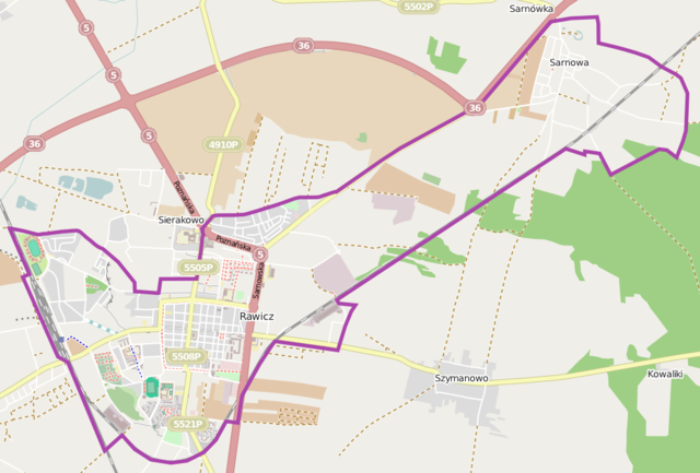
Location map of Rawicz, Poland This map of Rawicz was created from OpenStreetMap project data, collected by the community. This map may be incomplete, and may contain errors. Don't rely solely on it for navigation. |
|||||||||
| Date | (see file history) | |||||||||
| Source | You may find a page on the OpenStreetMap wiki page for Rawicz | |||||||||
| Creator |
OpenStreetMap contributors OpenStreetMap contributors |
|||||||||
| Permission (Reusing this file) |
OpenStreetMap data is available under the Open Database License (details). Standard style map tiles are licensed as ODbL Produced Works.
|
|||||||||
| Geotemporal data | ||||||||||
| Bounding box |
|
|||||||||
| Georeferencing | If inappropriate please set warp_status = skip to hide. | |||||||||
File history
Click on a date/time to view the file as it appeared at that time.
| Date/Time | Thumbnail | Dimensions | User | Comment | |
|---|---|---|---|---|---|
| current | 08:11, 30 May 2014 | | 1,000 × 677 (315 KB) | VanWiel (talk | contribs) | border |
| 12:10, 5 December 2013 |  | 789 × 520 (182 KB) | Powerek38 (talk | contribs) | VicuñaUploader 1.20 |
You cannot overwrite this file.
File usage on Commons
There are no pages that use this file.
File usage on other wikis
The following other wikis use this file:
- Usage on fr.wikipedia.org
- Usage on pl.wikipedia.org
- Rawicz (stacja kolejowa)
- Sarnowa (Rawicz)
- Ratusz w Rawiczu
- Sarnowa (ładownia kolejowa)
- Rawicz Wschód
- Parafia Chrystusa Króla i Zwiastowania Najświętszej Maryi Panny w Rawiczu
- Parafia św. Andrzeja Boboli w Rawiczu
- Parafia św. Andrzeja Apostoła w Rawiczu-Sarnowie
- Synagoga w Rawiczu
- Ratusz w Rawiczu-Sarnowej
- Zakład Karny w Rawiczu
- Kościół Chrystusa Króla i Zwiastowania Najświętszej Maryi Panny w Rawiczu
- Kościół Świętego Andrzeja Apostoła w Rawiczu-Sarnowie
- Kościół Świętego Andrzeja Boboli w Rawiczu
- Dwór w Sarnowie
- Klasztor franciszkanów reformatów w Rawiczu
- Muzeum Ziemi Rawickiej w Rawiczu
- Moduł:Mapa/dane/Rawicz
- Stadion im. Floriana Kapały w Rawiczu
- Osiedle Sierakowo
- Bractwo Kurkowe w Rawiczu
- Planty (Rawicz)
- Usage on pl.wikibooks.org
- Usage on pt.wikipedia.org