File:Real Estate Assistance (remote-1).jpeg

Size of this preview: 750 × 600 pixels. Other resolutions: 300 × 240 pixels | 600 × 480 pixels | 960 × 768 pixels | 1,280 × 1,024 pixels | 2,560 × 2,048 pixels.
Original file (2,560 × 2,048 pixels, file size: 638 KB, MIME type: image/jpeg)
Captions
Captions
Add a one-line explanation of what this file represents
Summary
edit.jpeg&action=edit§ion=1)
| Description |
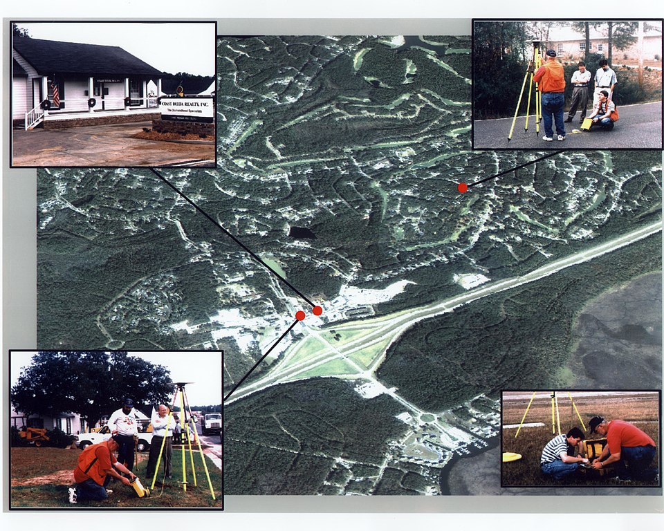
English: The Commercial Remote Sensing Program at Stennis Space Center assists numerous companies across the United States, in learning to use remote sensing capabilities to enhance their competitiveness. Through the Visiting Investigator Program, SSC helped Coast Delta Realty in Diamondhead, Miss., incorporate remote sensing and Geogrpahic Information System technology for real estate marketing and management. |
||
| Date | Taken in 1997 | ||
| Source |
Real Estate Assistance (direct link)
|
||
| Author | NASA Stennis Space Center |
Licensing
edit.jpeg&action=edit§ion=2)
| This file is in the public domain in the United States because it was solely created by NASA. NASA copyright policy states that "NASA material is not protected by copyright unless noted". (See Template:PD-USGov, NASA copyright policy page or JPL Image Use Policy.) | ||
 |
Warnings:
|
File history
Click on a date/time to view the file as it appeared at that time.
| Date/Time | Thumbnail | Dimensions | User | Comment | |
|---|---|---|---|---|---|
| current | 20:58, 26 May 2020 | | 2,560 × 2,048 (638 KB) | OptimusPrimeBot (talk | contribs) | #Spacemedia - Upload of https://www.ssc.nasa.gov/sirs/photos/applied/high/remote-1.jpg via Commons:Spacemedia |
You cannot overwrite this file.
File usage on Commons
There are no pages that use this file.
.jpeg&oldid=723954845)