File:Red Rock, River Clyst, Topsham - geograph.org.uk - 473706.jpg
No higher resolution available.
Red_Rock,_River_Clyst,_Topsham_-_geograph.org.uk_-_473706.jpg (640 × 480 pixels, file size: 57 KB, MIME type: image/jpeg)
Captions
Captions
Add a one-line explanation of what this file represents
Summary
edit
| Description |
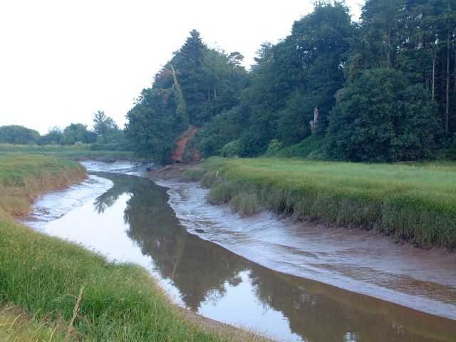
English: Red Rock, River Clyst, Topsham Topsham is built on a ridge of Permian red sandstone at the confluence where the smaller River Clyst flows into the Exe estuary. This shows an outcrop called Red Rock, to the west of the Clyst where it runs through reed beds toward the RSPB Bird Sanctuary and its outlet to the Exe. This section, downstream of the Bridge Inn and weir, is tidal. |
| Date | |
| Source | From geograph.org.uk |
| Author | Ray Girvan |
| Attribution (required by the license) | Ray Girvan / Red Rock, River Clyst, Topsham / |
| Camera location | | View this and other nearby images on: OpenStreetMap |
|---|
_heading:202.00&language=en)
| Object location | | View this and other nearby images on: OpenStreetMap |
|---|
_heading:202.00&language=en)
Licensing
edit

|
This image was taken from the Geograph project collection. See this photograph's page on the Geograph website for the photographer's contact details. The copyright on this image is owned by Ray Girvan and is licensed for reuse under the Creative Commons Attribution-ShareAlike 2.0 license.
|
This file is licensed under the Creative Commons Attribution-Share Alike 2.0 Generic license.
Attribution: Ray Girvan
- You are free:
- to share – to copy, distribute and transmit the work
- to remix – to adapt the work
- Under the following conditions:
- attribution – You must give appropriate credit, provide a link to the license, and indicate if changes were made. You may do so in any reasonable manner, but not in any way that suggests the licensor endorses you or your use.
- share alike – If you remix, transform, or build upon the material, you must distribute your contributions under the same or compatible license as the original.
File history
Click on a date/time to view the file as it appeared at that time.
| Date/Time | Thumbnail | Dimensions | User | Comment | |
|---|---|---|---|---|---|
| current | 23:08, 4 February 2011 | | 640 × 480 (57 KB) | GeographBot (talk | contribs) | == {{int:filedesc}} == {{Information |description={{en|1=Red Rock, River Clyst, Topsham Topsham is built on a ridge of Permian red sandstone at the confluence where the smaller River Clyst flows into the Exe estuary. This shows an outcrop called Red Rock, |
You cannot overwrite this file.
File usage on Commons
There are no pages that use this file.