File:Red Rocks, River Darwen, Hoghton - geograph.org.uk - 625647.jpg
No higher resolution available.
Red_Rocks,_River_Darwen,_Hoghton_-_geograph.org.uk_-_625647.jpg (640 × 480 pixels, file size: 108 KB, MIME type: image/jpeg)
Captions
Captions
Add a one-line explanation of what this file represents
Summary edit
| Description |
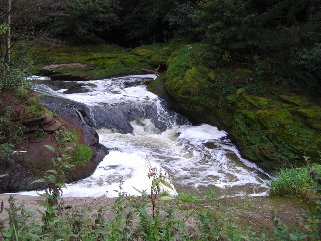
English: Red Rocks, River Darwen, Hoghton, Lancashire, England. Below the weir are shown a waterfall known as Red Rocks because of the colour of the stone. The water above the weir ran off to provide water for the mills. The water below the weir is a mass of foaming water when flooding because of the angle of the river turning 90 degrees. This could be an historical image as, since the photograph was taken, the weir and its waterfall may not now exist. |
| Date | |
| Source | From geograph.org.uk |
| Author | Alan Sillitoe |
| Attribution (required by the license) | Alan Sillitoe / Red Rocks, River Darwen, Hoghton / |
| Camera location | | View this and other nearby images on: OpenStreetMap |
|---|
_heading:90.00&language=en)
| Object location | | View this and other nearby images on: OpenStreetMap |
|---|
_heading:90.00&language=en)
Licensing edit

|
This image was taken from the Geograph project collection. See this photograph's page on the Geograph website for the photographer's contact details. The copyright on this image is owned by Alan Sillitoe and is licensed for reuse under the Creative Commons Attribution-ShareAlike 2.0 license.
|
This file is licensed under the Creative Commons Attribution-Share Alike 2.0 Generic license.
Attribution: Alan Sillitoe
- You are free:
- to share – to copy, distribute and transmit the work
- to remix – to adapt the work
- Under the following conditions:
- attribution – You must give appropriate credit, provide a link to the license, and indicate if changes were made. You may do so in any reasonable manner, but not in any way that suggests the licensor endorses you or your use.
- share alike – If you remix, transform, or build upon the material, you must distribute your contributions under the same or compatible license as the original.
File history
Click on a date/time to view the file as it appeared at that time.
| Date/Time | Thumbnail | Dimensions | User | Comment | |
|---|---|---|---|---|---|
| current | 06:44, 7 February 2011 | | 640 × 480 (108 KB) | GeographBot (talk | contribs) | == {{int:filedesc}} == {{Information |description={{en|1=Red Rocks, River Darwen, Hoghton Below the weir are waterfalls known as Red Rocks due to the colour of the stone. The water above the weir ran off to provide water for the mills. The water below |
You cannot overwrite this file.
File usage on Commons
There are no pages that use this file.
File usage on other wikis
The following other wikis use this file:
- Usage on en.wikipedia.org
- Usage on pt.wikipedia.org