File:Red Sea topographic map-ar.png

Size of this preview: 386 × 600 pixels. Other resolutions: 154 × 240 pixels | 309 × 480 pixels | 494 × 768 pixels | 659 × 1,024 pixels | 1,771 × 2,751 pixels.
Original file (1,771 × 2,751 pixels, file size: 4.59 MB, MIME type: image/png)
Captions
Captions
Add a one-line explanation of what this file represents
Summary edit
| Description |
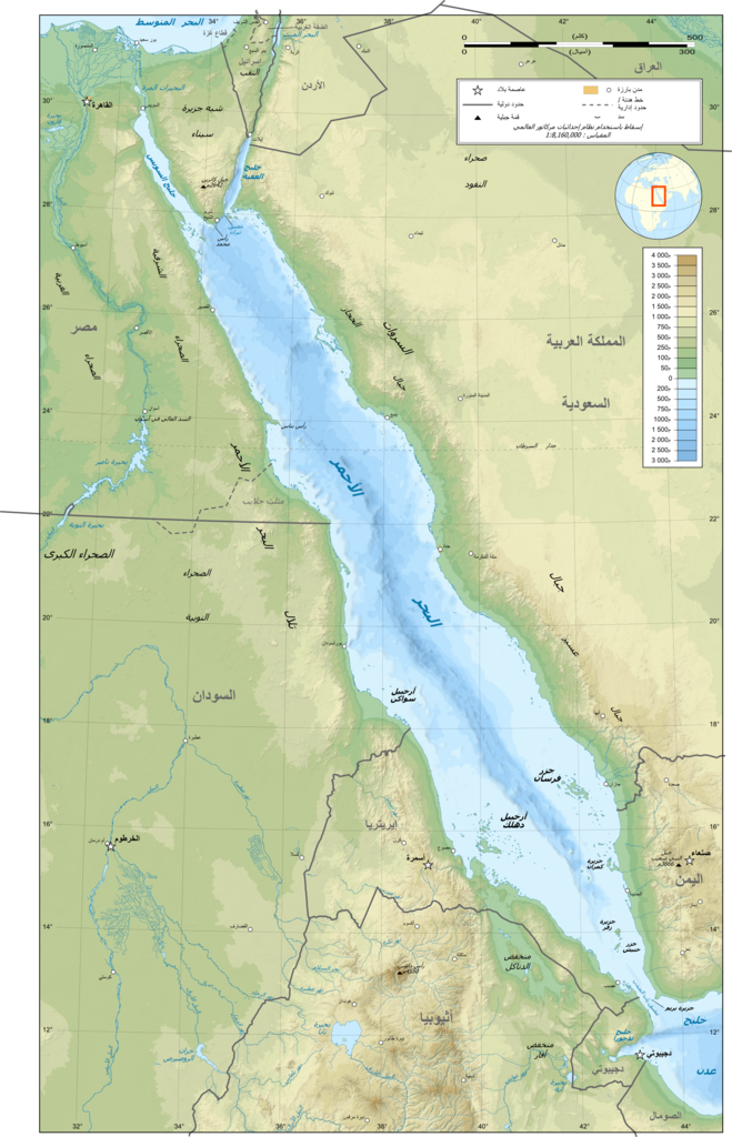
العربية: خريطة طوبوغرافية باللغة العربية للبحر الأحمر. |
| Date | (UTC) |
| Source |
This file was derived from: Red Sea topographic map-en.jpg:  |
| Author |
|
| This is a retouched picture, which means that it has been digitally altered from its original version. Modifications: translated to Arabic. The original can be viewed here: Red Sea topographic map-en.jpg:
|
Licensing edit
I, the copyright holder of this work, hereby publish it under the following licenses:
This file is licensed under the Creative Commons Attribution-Share Alike 3.0 Unported, 2.5 Generic, 2.0 Generic and 1.0 Generic license.
- You are free:
- to share – to copy, distribute and transmit the work
- to remix – to adapt the work
- Under the following conditions:
- attribution – You must give appropriate credit, provide a link to the license, and indicate if changes were made. You may do so in any reasonable manner, but not in any way that suggests the licensor endorses you or your use.
- share alike – If you remix, transform, or build upon the material, you must distribute your contributions under the same or compatible license as the original.

|
Permission is granted to copy, distribute and/or modify this document under the terms of the GNU Free Documentation License, Version 1.2 or any later version published by the Free Software Foundation; with no Invariant Sections, no Front-Cover Texts, and no Back-Cover Texts. A copy of the license is included in the section entitled GNU Free Documentation License. |
You may select the license of your choice.
Original upload log edit
This image is a derivative work of the following images:
- File:Red_Sea_topographic_map-en.jpg licensed with Cc-by-sa-3.0,2.5,2.0,1.0, GFDL
- 2010-07-19T13:37:50Z Sting 1655x2705 (1756821 Bytes) Color profile
- 2008-09-02T04:47:27Z Sting 1655x2705 (1682874 Bytes) New standard colors ; bathymetry from ETOPO1 ; etc.
- 2008-04-03T19:35:00Z Sting 1655x2705 (1755258 Bytes) Additional corrections
- 2008-04-03T13:09:39Z Sting 1655x2705 (1788416 Bytes) Some names corrections ; some improvements
- 2008-04-03T11:26:39Z Sting 1655x2705 (1755771 Bytes) Little correction
- 2008-04-02T22:32:11Z Sting 1655x2705 (1786591 Bytes) {{Location|21|00|00|N|38|00|00|E|scale:10000000}} {{Information |Description={{en|Topographic map in English of the [[:en:Red Sea|red Sea]]''Note :'' for translation purpose, use the [[:Image:Red_Sea_topographic_map-en.svg|S
Uploaded with derivativeFX }}
File history
Click on a date/time to view the file as it appeared at that time.
| Date/Time | Thumbnail | Dimensions | User | Comment | |
|---|---|---|---|---|---|
| current | 22:17, 10 July 2012 | | 1,771 × 2,751 (4.59 MB) | باسم (talk | contribs) | == {{int:filedesc}} == {{Information |Description={{ar|خريطة طوبوغرافية باللغة العربية للبحر الأحمر. |Source={{Derived from|Red_Sea_topographic_map-en.jpg|display=50}} |Date=2012-07... |
You cannot overwrite this file.
File usage on Commons
The following 10 pages use this file:
- File:Red Sea map-blank.svg
- File:Red Sea topographic map-de.svg
- File:Red Sea topographic map-en.jpg
- File:Red Sea topographic map-en.svg
- File:Red Sea topographic map-eo.svg
- File:Red Sea topographic map-fr.jpg
- File:Red Sea topographic map-fr.svg
- File:Red Sea topographic map-mk.svg
- Template:Other versions/Red Sea topographic map
- Template:Other versions/Seine basin topographic map
File usage on other wikis
The following other wikis use this file:
- Usage on ar.wikipedia.org
- Usage on sn.wikipedia.org