File:Região-Administrativa-RA-Governo-Estado-de-SaoPaulo.png
Size of this preview: 800 × 566 pixels. Other resolutions: 320 × 226 pixels | 640 × 453 pixels | 1,024 × 724 pixels | 1,280 × 905 pixels | 2,079 × 1,470 pixels.
Original file (2,079 × 1,470 pixels, file size: 501 KB, MIME type: image/png)
Captions
Captions
Add a one-line explanation of what this file represents
Summary
edit
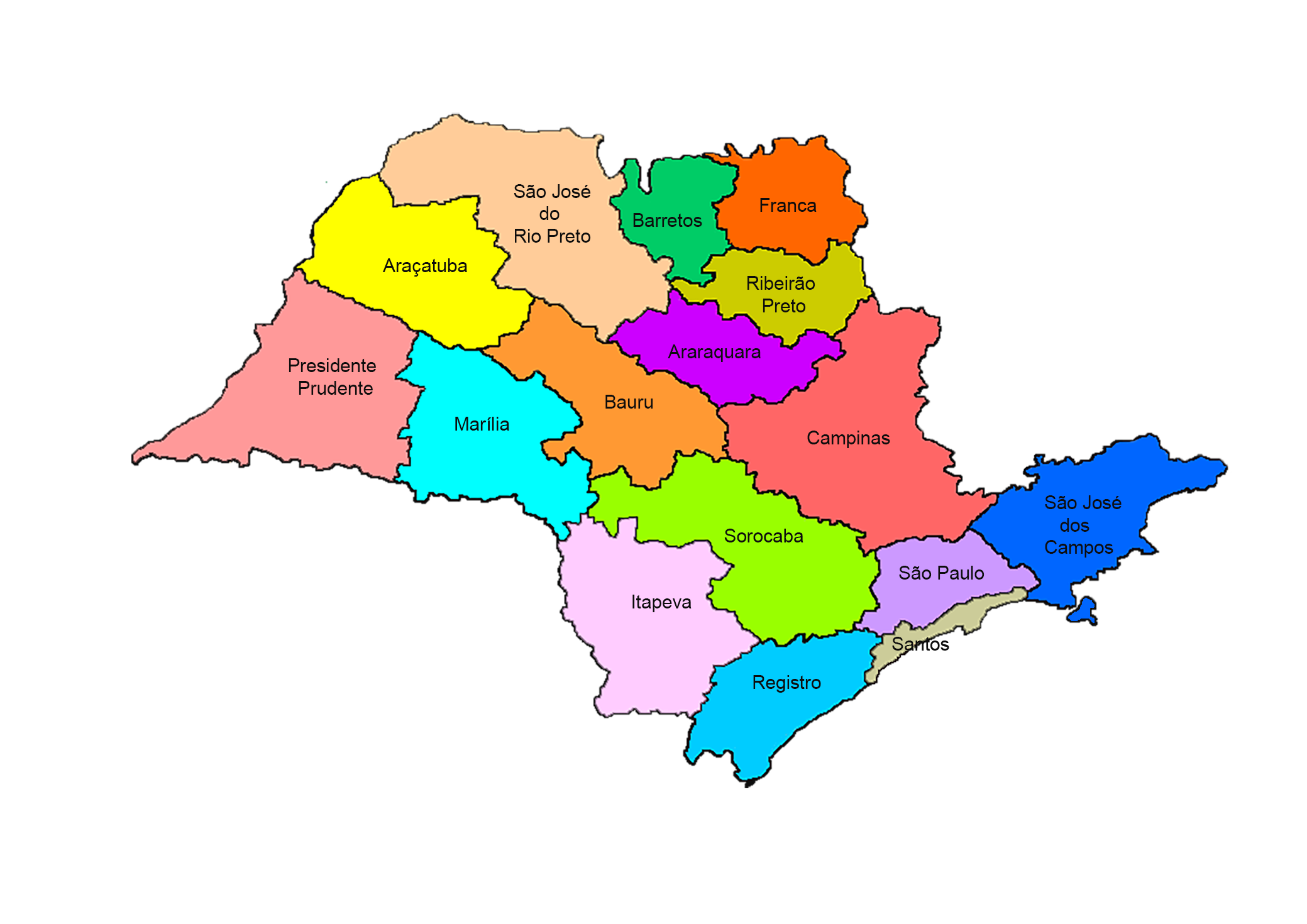
Description (English): Map of the Administrative Region (RA) of the Government of the State of São Paulo (Brazil) (October/2018)
| Description |
Português: Mapa da Região Administrativa (RA) do Governo do Estado de São Paulo (Brasil) |
| Date | |
| Source | Secretaria de Agricultura e Abastecimento (Brasil) / Instituto de Economia Agrícola (IEA) Brasil / Escritório de Desenvolvimento Rural (EDR) Brasil = http://www.iea.sp.gov.br/out/mapa.html = The Government of Brazil sites authorize the free download of maps of Brazil. |
| Author | Secretaria de Agricultura e Abastecimento (Brasil) / Instituto de Economia Agrícola (IEA) Brasil / Escritório de Desenvolvimento Rural (EDR) Brasil = http://www.iea.sp.gov.br/out/mapa.html |
Licensing
edit
This file is licensed under the Creative Commons Attribution-Share Alike 3.0 Unported license.
- You are free:
- to share – to copy, distribute and transmit the work
- to remix – to adapt the work
- Under the following conditions:
- attribution – You must give appropriate credit, provide a link to the license, and indicate if changes were made. You may do so in any reasonable manner, but not in any way that suggests the licensor endorses you or your use.
- share alike – If you remix, transform, or build upon the material, you must distribute your contributions under the same or compatible license as the original.
File history
Click on a date/time to view the file as it appeared at that time.
| Date/Time | Thumbnail | Dimensions | User | Comment | |
|---|---|---|---|---|---|
| current | 04:33, 5 October 2018 | | 2,079 × 1,470 (501 KB) | Amgauna (talk | contribs) | User created page with UploadWizard |
You cannot overwrite this file.
File usage on Commons
There are no pages that use this file.
File usage on other wikis
The following other wikis use this file:
- Usage on pt.wikipedia.org
- Usage on www.wikidata.org