File:Região Metropolitana de Salvador.png

Size of this preview: 696 × 600 pixels. Other resolutions: 279 × 240 pixels | 557 × 480 pixels | 891 × 768 pixels | 1,151 × 992 pixels.
Original file (1,151 × 992 pixels, file size: 1.38 MB, MIME type: image/png)
Captions
Captions
Add a one-line explanation of what this file represents
Summary
edit
| Description |
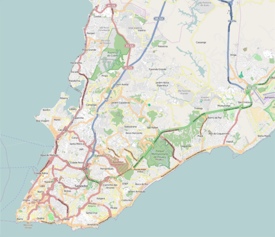
Português: Mapa da Região Metropolitana de Salvador. |
| Date | |
| Source | http://www.openstreetmap.org |
| Author | OpenStreetMap |
Coordenadas de borda
edit
| -12.8374 | ||
| -38.5462 | -38.3267 | |
| -13.0220 |
Licensing
edit
| Description |
This map was created from OpenStreetMap project data, collected by the community. This map may be incomplete, and may contain errors. Don't rely solely on it for navigation. |
|||
| Date | (see file history) | |||
| Source | openstreetmap.org | |||
| Creator |
OpenStreetMap contributors |
|||
| Permission (Reusing this file) |
OpenStreetMap data is available under the Open Database License (details). Map tiles are licensed under the Creative Commons Attribution-ShareAlike 2.0 license (CC-BY-SA 2.0).
This file is licensed under the Creative Commons Attribution-Share Alike 2.0 Generic license.
|
|||
| Georeferencing | If inappropriate please set warp_status = skip to hide. |
File history
Click on a date/time to view the file as it appeared at that time.
| Date/Time | Thumbnail | Dimensions | User | Comment | |
|---|---|---|---|---|---|
| current | 03:39, 26 April 2015 | | 1,151 × 992 (1.38 MB) | Porto Mineiro (talk | contribs) | Corrigindo detalhes. |
| 03:13, 26 April 2015 |  | 1,151 × 992 (1.23 MB) | Porto Mineiro (talk | contribs) | Mapa mais detalhado. | |
| 03:03, 26 April 2015 |  | 1,150 × 991 (959 KB) | Porto Mineiro (talk | contribs) | User created page with UploadWizard |
You cannot overwrite this file.
File usage on Commons
There are no pages that use this file.
File usage on other wikis
The following other wikis use this file:
- Usage on en.wikipedia.org
- Usage on pt.wikipedia.org
- Mercado Modelo
- Subdivisões de Salvador
- Terminal Rodoviário de Salvador
- Palácio dos Esportes
- Terminal Turístico Náutico da Bahia
- Estação Lapa (Salvador)
- Estação Campo da Pólvora
- Estação Acesso Norte
- Estação Brotas
- Estação Retiro (Salvador)
- Terminal Hidroviário de São Joaquim
- Terminal Marítimo de Plataforma
- Estação Bom Juá
- Predefinição:Mapa de localização/Região Metropolitana de Salvador
- Estação Santa Luzia (CTB)
- Estação Calçada
- Estação Bonocô
- Estação Pirajá
- Terminal Marítimo da Ribeira
- Estação Imbuí
- Estação Pernambués
- Estação CAB
- Estação Pituaçu
- Estação Rodoviária (Salvador)
- Estação Detran
- Estação Flamboyant
- Estação Tamburugy
- Estação Bairro da Paz
- Estação Mussurunga
- Estação Aeroporto (Bahia)
- Estação Paripe
- Estação Almeida Brandão
- Usage on vep.wikipedia.org