File:Reilly Karte von Grossbritannien und Ireland.jpg
No higher resolution available.
Reilly_Karte_von_Grossbritannien_und_Ireland.jpg (621 × 498 pixels, file size: 89 KB, MIME type: image/jpeg)
Captions
Captions
Add a one-line explanation of what this file represents
Summary
edit
| Description |
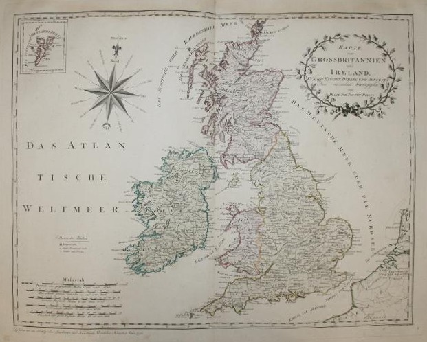
Deutsch: Karte von Grossbritannien und Ireland. Nach Kitchin, Dorret und Jefferys. Kolorierter Kupferstich. Aus Grosser Deutscher Atlas. Tafel 10, Plattengröße: 50,2 × 64,3 cm. Karte ca. 46 × 60 cm |
|||||||||||||||||||||||||
| Date | between 1794 and 1796 | |||||||||||||||||||||||||
| Source | http://cgi.ebay.de/ws/eBayISAPI.dll?ViewItem&item=110543871577 | |||||||||||||||||||||||||
| Author |
|
|||||||||||||||||||||||||
| Permission (Reusing this file) |
PD-art | |||||||||||||||||||||||||
Licensing
edit
|
This is a faithful photographic reproduction of a two-dimensional, public domain work of art. The work of art itself is in the public domain for the following reason:
The official position taken by the Wikimedia Foundation is that "faithful reproductions of two-dimensional public domain works of art are public domain".
This photographic reproduction is therefore also considered to be in the public domain in the United States. In other jurisdictions, re-use of this content may be restricted; see Reuse of PD-Art photographs for details. | ||||
File history
Click on a date/time to view the file as it appeared at that time.
| Date/Time | Thumbnail | Dimensions | User | Comment | |
|---|---|---|---|---|---|
| current | 13:45, 24 July 2010 | | 621 × 498 (89 KB) | Ephraim33 (talk | contribs) | bigger version |
| 11:11, 24 July 2010 |  | 415 × 325 (55 KB) | Ephraim33 (talk | contribs) | {{Information |Description={{de|Karte von Grossbritannien und Ireland. Nach Kitchin, Dorret und Jefferys. Kolorierter Kupferstich. Aus ''Grosser Deutscher Atlas.''}} |Source=http://cgi.ebay.de/ws/eBayISAPI.dll?ViewItem&item=140407548420 |Date=1794–1796 |
You cannot overwrite this file.
File usage on Commons
There are no pages that use this file.