File:Relief map of Italien Molise.png
Size of this preview: 754 × 600 pixels. Other resolutions: 302 × 240 pixels | 604 × 480 pixels | 966 × 768 pixels | 1,280 × 1,018 pixels | 1,521 × 1,210 pixels.
Original file (1,521 × 1,210 pixels, file size: 2.16 MB, MIME type: image/png)
Captions
Captions
Add a one-line explanation of what this file represents
Summary
edit
| Description |
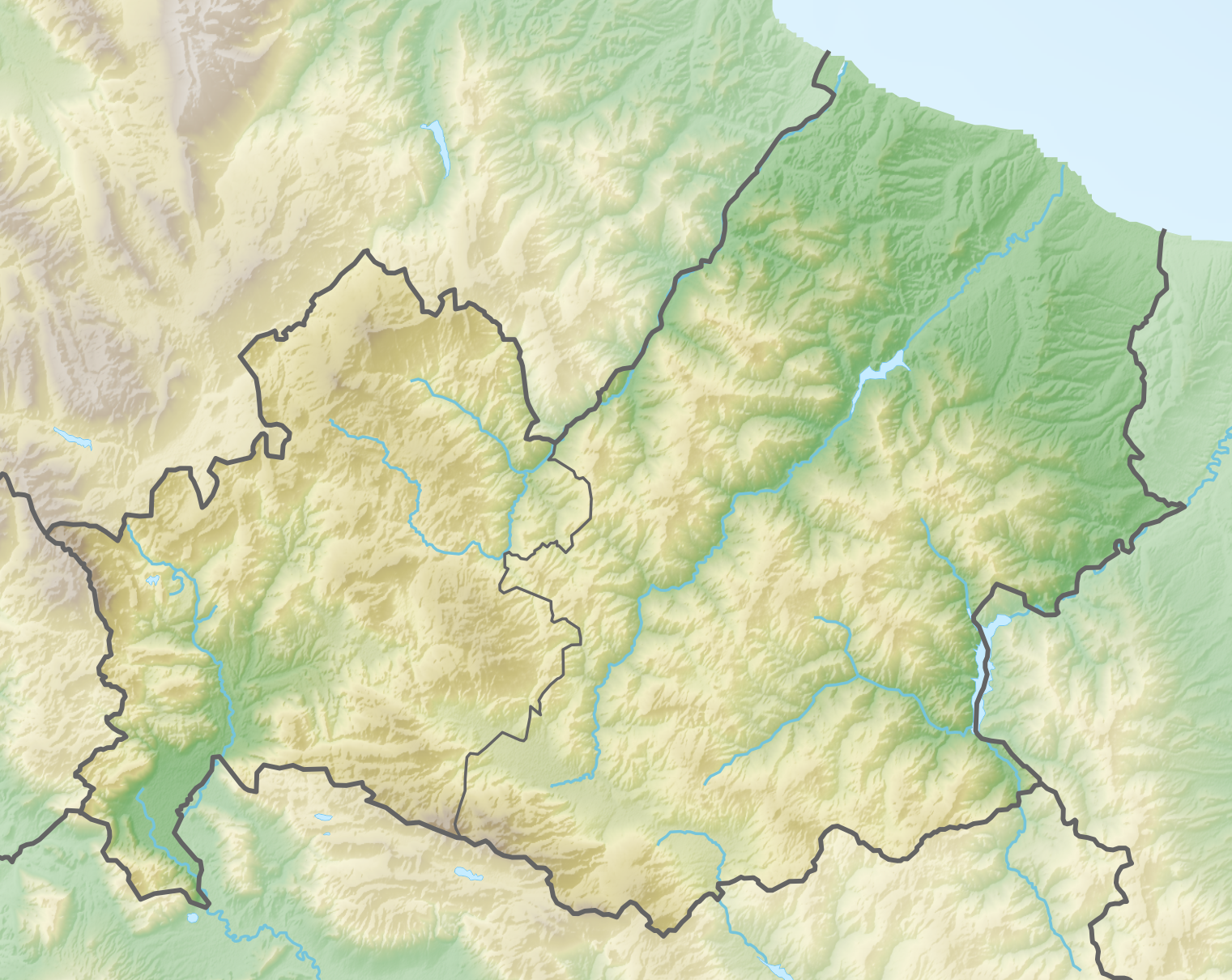
Deutsch: Positionskarte von Molise (Italien) English: Location map of Molise region (Italy) Español: Mapa de localización de la Región de Molise (Italia).
Equirectangular projection, N/S stretching 115 %. Geographic limits of the map:
|
| Date | |
| Source | Own work |
| Author | Tschubby |
Licensing
edit
I, the copyright holder of this work, hereby publish it under the following licenses:

|
Permission is granted to copy, distribute and/or modify this document under the terms of the GNU Free Documentation License, Version 1.2 or any later version published by the Free Software Foundation; with no Invariant Sections, no Front-Cover Texts, and no Back-Cover Texts. A copy of the license is included in the section entitled GNU Free Documentation License. |
This file is licensed under the Creative Commons Attribution-Share Alike 3.0 Unported license.
- You are free:
- to share – to copy, distribute and transmit the work
- to remix – to adapt the work
- Under the following conditions:
- attribution – You must give appropriate credit, provide a link to the license, and indicate if changes were made. You may do so in any reasonable manner, but not in any way that suggests the licensor endorses you or your use.
- share alike – If you remix, transform, or build upon the material, you must distribute your contributions under the same or compatible license as the original.
You may select the license of your choice.
File history
Click on a date/time to view the file as it appeared at that time.
| Date/Time | Thumbnail | Dimensions | User | Comment | |
|---|---|---|---|---|---|
| current | 16:09, 4 April 2019 | | 1,521 × 1,210 (2.16 MB) | Tschubby (talk | contribs) | == {{int:filedesc}} == {{Information |description={{de|Positionskarte von Molise (Italien)}}{{en|Location map of Molise region (Italy)}}{{es|1=Mapa de localización de la Región de Molise (Italia).}} Equirectangular projection, N/S stretching 115 %. Geographic limits of the map: * N: 42.119° N * S: 41.329° N * W: 13.889° E * E: 15.213° E Topographischer Hintergrund: [http://www2.jpl.nasa.gov/srtm NASA Shuttle Radar Topography Mission] (public domai... |
You cannot overwrite this file.
File usage on Commons
The following page uses this file:
File usage on other wikis
The following other wikis use this file:
- Usage on als.wikipedia.org
- Usage on be.wikipedia.org
- Usage on bg.wikipedia.org
- Рокета а Волтурно
- Изерния
- Бояно
- Венафро
- Сепино
- Кампобасо
- Термоли
- Баранело
- Шаблон:ПК Италия Молизе
- Аньоне
- Фрозолоне
- Песке
- Филиняно
- Акуавива д'Изерния
- Баньоли дел Триньо
- Киаучи
- Вастоджирарди
- Белмонте дел Санио
- Канталупо нел Санио
- Капракота
- Каровили
- Карпиноне
- Кастел дел Джудиче
- Сант'Анджело дел Песко
- Чивитанова дел Санио
- Кастел Сан Винченцо
- Кастелверино
- Кастелпетрозо
- Кастелпицуто
- Коли а Волтурно
- Конка Казале
- Лонгано
- Макия д'Изерния
- Макиагодена
- Миранда (Италия)
- Монтакуила
- Монтенеро Вал Кокиара
- Монтеродуни
- Песколанчано
- Пескопенатаро
- Петоранело дел Молизе
- Пиетрабонданте
- Пицоне
- Поджо Санита
- Поцили
- Рионеро Санитико
- Роказикура
- Рокамандолфи
View more global usage of this file.