File:Reliefkarte Ungarn.png

Size of this preview: 800 × 517 pixels. Other resolutions: 320 × 207 pixels | 640 × 414 pixels | 1,024 × 662 pixels | 1,280 × 827 pixels | 2,560 × 1,655 pixels | 3,322 × 2,147 pixels.
Original file (3,322 × 2,147 pixels, file size: 11.09 MB, MIME type: image/png)
Captions
Captions
Add a one-line explanation of what this file represents
Summary
edit| Description |
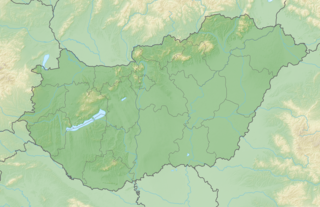
Deutsch: Reliefkarte Ungarn
Topographischer Hintergrund: NASA Shuttle Radar Topography Mission (public domain). SRTM3 v.2. |
||||||||
| Date | |||||||||
| Source | Own work | ||||||||
| Author | Tschubby | ||||||||
| Permission (Reusing this file) |
I, the copyright holder of this work, hereby publish it under the following licenses:
This file is licensed under the Creative Commons Attribution-Share Alike 2.5 Generic, 2.0 Generic and 1.0 Generic license.
You may select the license of your choice. |

File history
Click on a date/time to view the file as it appeared at that time.
| Date/Time | Thumbnail | Dimensions | User | Comment | |
|---|---|---|---|---|---|
| current | 19:42, 4 May 2018 | | 3,322 × 2,147 (11.09 MB) | Tschubby (talk | contribs) | == {{int:filedesc}} == {{Information |Description= {{de| Reliefkarte Ungarn}} Topographischer Hintergrund: [http://www2.jpl.nasa.gov/srtm NASA Shuttle Radar Topography Mission] (public domain). SRTM3 v.2. |Source={{own}} |Date= 2018-05-04 |Author= Tschubby |Permission= {{self|GFDL|Cc-by-sa-3.0-migrated|Cc-by-sa-2.5,2.0,1.0}} |other_versions= }} Category:Location maps of Hungary Category:Maps of Hungary |
You cannot overwrite this file.
File usage on Commons
There are no pages that use this file.
File usage on other wikis
The following other wikis use this file:
- Usage on bg.wikipedia.org
- Будапеща
- Кечкемет
- Сексард
- Дьор
- Сегед
- Шиофок
- Дебрецен
- Обуда
- Пеща
- Мишколц
- Печ (Унгария)
- Балатон
- Кишкьорьош
- Мохач
- Секешфехервар
- Татабаня
- Чеснек
- Бекешчаба
- Солнок
- Шалготарян
- Капошвар
- Ниредхаза
- Сомбатхей
- Веспрем
- Залаегерсег
- Егер
- Ечер
- Шопрон
- Надканижа
- Буда (град)
- Шаблон:ПК Унгария
- Казинцбарцика
- Захон
- Вечеш
- Дравасоболч
- Раба
- Рьоске
- Сигетсентмиклош
- Зичиуйфалу
- Дунауйварош
- Ерд
- Ходмезьовашархей
- Цеглед
- Озд
- Вац
- Папа (град)
- Дунакеси
- Дьондьош
- Гьодьольо
- Литер
View more global usage of this file.