File:Remarques sur la navigation de terre-neuve à New-York afin deviter les courrants et les bas-fonds au sud de Nantuckett et du Banc de George ... (8249585309).jpg

Size of this preview: 783 × 600 pixels. Other resolutions: 313 × 240 pixels | 627 × 480 pixels | 1,003 × 768 pixels | 1,280 × 980 pixels | 2,000 × 1,532 pixels.
Original file (2,000 × 1,532 pixels, file size: 2.77 MB, MIME type: image/jpeg)
Captions
Captions
Add a one-line explanation of what this file represents
Summary edit
.jpg&action=edit§ion=1)
| Description |
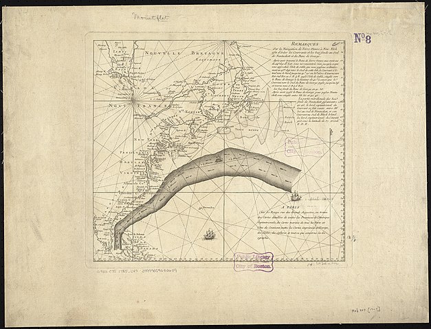
Zoom into this map at maps.bpl.org. Author: Publisher: Le Rouge, Georges-Louis Date: 1785 Location: Gulf Stream Dimensions: 32 x 36 cm. Scale: Scale not given Call Number: G9111.C75 1785 .L47 |
| Date | |
| Source |
|
| Author | http://maps.bpl.org |
Licensing edit
.jpg&action=edit§ion=2)
This file is licensed under the Creative Commons Attribution 2.0 Generic license.
- You are free:
- to share – to copy, distribute and transmit the work
- to remix – to adapt the work
- Under the following conditions:
- attribution – You must give appropriate credit, provide a link to the license, and indicate if changes were made. You may do so in any reasonable manner, but not in any way that suggests the licensor endorses you or your use.
| This image, originally posted to Flickr, was reviewed on 21 August 2013 by the administrator or reviewer File Upload Bot (Magnus Manske), who confirmed that it was available on Flickr under the stated license on that date. |
File history
Click on a date/time to view the file as it appeared at that time.
| Date/Time | Thumbnail | Dimensions | User | Comment | |
|---|---|---|---|---|---|
| current | 03:55, 21 August 2013 | | 2,000 × 1,532 (2.77 MB) | File Upload Bot (Magnus Manske) (talk | contribs) | Transferred from Flickr by User:tm |
You cannot overwrite this file.
File usage on Commons
There are no pages that use this file.
.jpg&oldid=758240342)