File:Richard Pococke, Ein Grundriss von Ierusalem und dem daran stossenden Lande (FL6882433 2368153).jpg

Size of this preview: 800 × 588 pixels. Other resolutions: 320 × 235 pixels | 640 × 470 pixels | 1,024 × 752 pixels | 1,280 × 940 pixels | 2,560 × 1,880 pixels | 2,900 × 2,130 pixels.
Original file (2,900 × 2,130 pixels, file size: 2.38 MB, MIME type: image/jpeg)
Captions
Captions
Add a one-line explanation of what this file represents
Summary
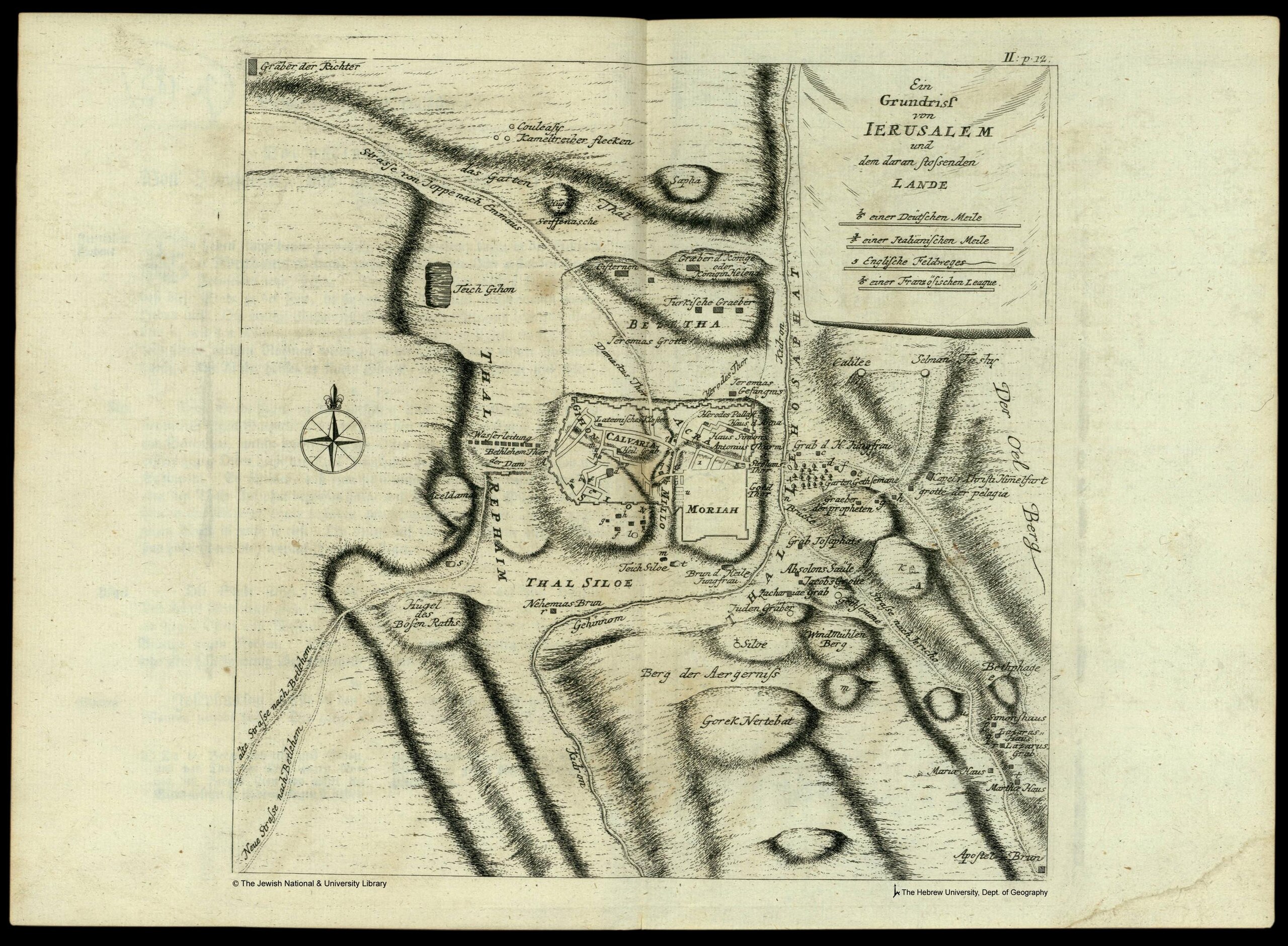
edit| Richard Pococke: Ein Grundriss von Ierusalem und dem daran stossenden Lande
( |
||||||||||||||||||||||||
|---|---|---|---|---|---|---|---|---|---|---|---|---|---|---|---|---|---|---|---|---|---|---|---|---|
| Artist |
|
|||||||||||||||||||||||
| Title |
Ein Grundriss von Ierusalem und dem daran stossenden Lande |
|||||||||||||||||||||||
| Description |
Ein Grundriss von Ierusalem und dem daran stossenden Lande. |
|||||||||||||||||||||||
| Language | German | |||||||||||||||||||||||
| Publication date | 1754 | |||||||||||||||||||||||
| Dimensions | 224 × 220 mm (8.81 × 8.66 in) | |||||||||||||||||||||||
| Collection |
|
|||||||||||||||||||||||
| Current location |
|
|||||||||||||||||||||||
| Place of publication | Erlangen | |||||||||||||||||||||||
| search Merhav catalog | Erlangen | |||||||||||||||||||||||
| Notes | Copperplate; Plan; Shows all the roads to Jaffa, Bethlehem, Jericho, etc.; From: Pococke, Richard. Reschreibung des Morgenlandes, erlangen, 1754. Der zweite Theil von Palaestina, p.12, [29 V 3221, Vol.2]. | |||||||||||||||||||||||
| IE PID | IE6882431 | |||||||||||||||||||||||
| Rosetta filename | FL6882433 | |||||||||||||||||||||||
| NNL item ID (P3959) | 990023681530205171 | |||||||||||||||||||||||
| search Merhav catalog | German, Richard Pococke | |||||||||||||||||||||||
| Source/Photographer |
|
|||||||||||||||||||||||
| Other versions | ||||||||||||||||||||||||
| Jpg / Tif version |
|
|||||||||||||||||||||||


.jpg)

.jpg&action=edit§ion=1)
Licensing
edit.jpg&action=edit§ion=2)
The copyright situation of this work is theoretically uncertain, because in the country of origin copyright lasts 70 years after the death of the author, and the date of the author's death is unknown. However, the date of creation of the work was over 120 years ago, and it is thus a reasonable assumption that the copyright has expired (see here for the community discussion). Do not use this template if the date of death of the author is known.
| |
| This file has been identified as being free of known restrictions under copyright law, including all related and neighboring rights. | |
File history
Click on a date/time to view the file as it appeared at that time.
| Date/Time | Thumbnail | Dimensions | User | Comment | |
|---|---|---|---|---|---|
| current | 00:11, 28 July 2023 | | 2,900 × 2,130 (2.38 MB) | Geagea (talk | contribs) | pattypan 22.03 |
You cannot overwrite this file.
File usage on Commons
The following page uses this file:
.jpg&oldid=787441187)