File:Rigi-First.jpg

Size of this preview: 800 × 533 pixels. Other resolutions: 320 × 213 pixels | 640 × 427 pixels | 1,024 × 683 pixels | 1,280 × 853 pixels | 2,996 × 1,997 pixels.
Original file (2,996 × 1,997 pixels, file size: 1.2 MB, MIME type: image/jpeg)
Captions
Captions
Add a one-line explanation of what this file represents
Summary
edit
![]() Switzerland
Switzerland ![]() Canton of Lucerne - Schwyzer Alpen 1.453 m ü. M.
Canton of Lucerne - Schwyzer Alpen 1.453 m ü. M.
| Description |
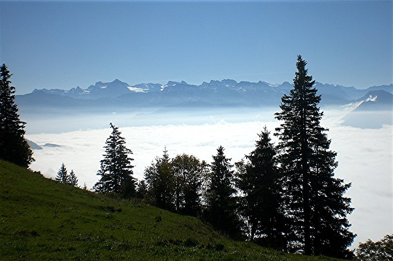
Deutsch: Von Rigi First schauen wir (über die im Nebelmeer verdeckte Obere und Untere Nas am Vierwaldstättersee) zur Klewenalp und auf die Kette der Urner Alpen. Wissiflue (links) ist eingetaucht, rechts ist noch das Buochserhorn zu sehen. |
| Date | Taken on 17 October 2011, 13:10:13 |
| Source | Own work |
| Author | FkMohr, Fotografin Supakon Mohr |
| Camera location | | View this and other nearby images on: OpenStreetMap |
|---|
LU {BT111017-1310} übertragen von Panoramio (User Mohr=1080936, Bild 60875806).
Licensing
edit
Supakon Mohr, the copyright holder of this work, hereby publishes it under the following license:
This file is licensed under the Creative Commons Attribution-Share Alike 3.0 Germany license.
Attribution: Supakon Mohr
- You are free:
- to share – to copy, distribute and transmit the work
- to remix – to adapt the work
- Under the following conditions:
- attribution – You must give appropriate credit, provide a link to the license, and indicate if changes were made. You may do so in any reasonable manner, but not in any way that suggests the licensor endorses you or your use.
- share alike – If you remix, transform, or build upon the material, you must distribute your contributions under the same or compatible license as the original.

File history
Click on a date/time to view the file as it appeared at that time.
| Date/Time | Thumbnail | Dimensions | User | Comment | |
|---|---|---|---|---|---|
| current | 08:35, 17 September 2017 | | 2,996 × 1,997 (1.2 MB) | FkMohr (talk | contribs) | Transferred from http://static.panoramio.com/photos/original/60875806.jpg |
You cannot overwrite this file.
File usage on Commons
There are no pages that use this file.