File:Rio Grande da Serra Paranapiacaba Sao Paolo map.png

Size of this preview: 800 × 567 pixels. Other resolutions: 320 × 227 pixels | 640 × 453 pixels | 1,024 × 725 pixels | 1,186 × 840 pixels.
Original file (1,186 × 840 pixels, file size: 1.22 MB, MIME type: image/png)
Captions
Captions
Add a one-line explanation of what this file represents
Summary edit
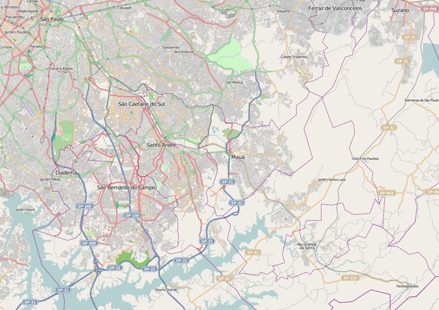
| Description |
English: Map showing Rio Grande da Serra and Paranapiacaba in relation to Sao Paulo centre.
This file is licensed under the Creative Commons Attribution-Share Alike 2.0 Generic license.
|
||
| Date | |||
| Source | Maps for Free (Open Street Map) | ||
| Creator | |||
| Georeferencing | If inappropriate please set warp_status = skip to hide. | ||
| Other versions |
|

File history
Click on a date/time to view the file as it appeared at that time.
| Date/Time | Thumbnail | Dimensions | User | Comment | |
|---|---|---|---|---|---|
| current | 19:16, 26 January 2013 | | 1,186 × 840 (1.22 MB) | Blofeld Dr. (talk | contribs) | {{Information |Description ={{en|1=s}} |Source =s |Author =s |Date =s |Permission = |other_versions = }} |
You cannot overwrite this file.
File usage on Commons
There are no pages that use this file.
File usage on other wikis
The following other wikis use this file:
- Usage on en.wikipedia.org
- Usage on sco.wikipedia.org