File:Risques-technologiques.jpg
Size of this preview: 800 × 387 pixels. Other resolutions: 320 × 155 pixels | 640 × 309 pixels | 1,024 × 495 pixels | 1,280 × 618 pixels | 3,568 × 1,724 pixels.
Original file (3,568 × 1,724 pixels, file size: 2.15 MB, MIME type: image/jpeg)
File information
Structured data
Captions
Summary
editDescriptionRisques-technologiques.jpg |
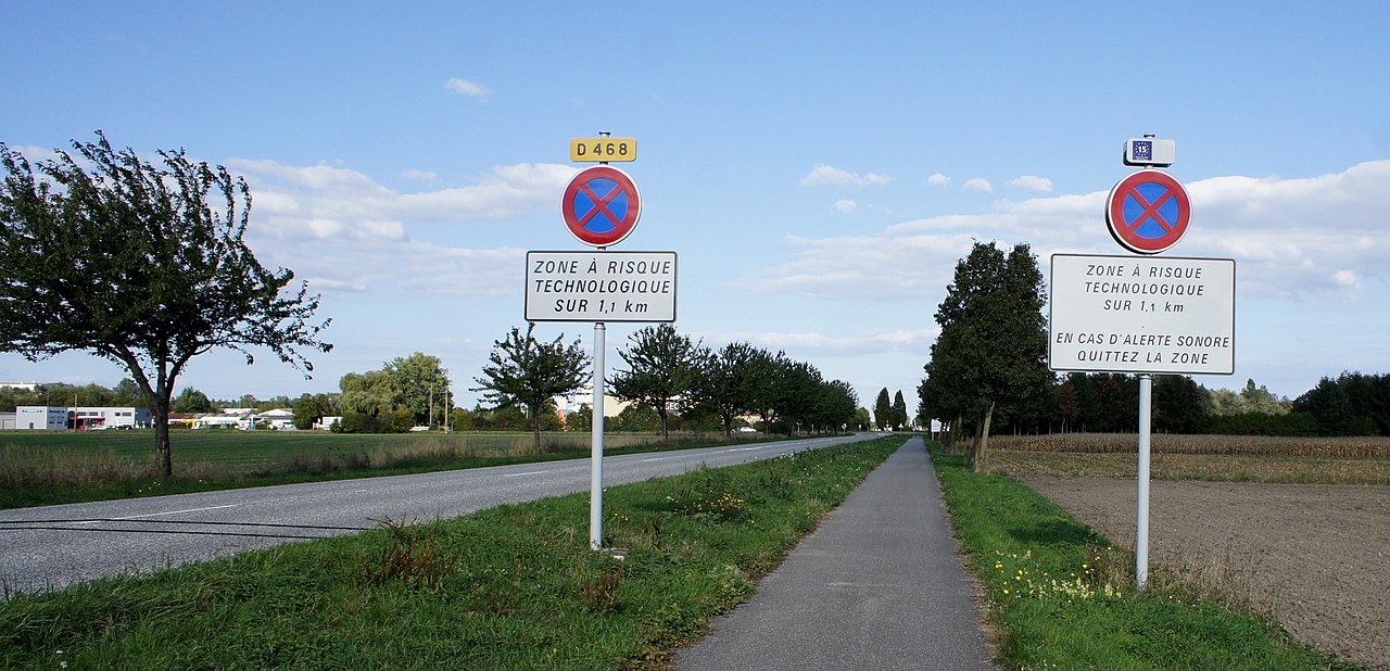
English: Sign telling people they are entering a area with technical risks. This area is limited around the Dow Chemicals AgroSciences campus in Drusenheim in Alsace, France. |
Date | |
Source | Own work |
Author | Aloxe |
Camera location | 48° 44′ 23.32″ N, 7° 55′ 00″ E | View this and other nearby images on: OpenStreetMap | 48.739811; 7.916667 |
---|
Licensing
editI, the copyright holder of this work, hereby publish it under the following license:
Copyleft: This work of art is free; you can redistribute it and/or modify it according to terms of the Free Art License. You will find a specimen of this license on the Copyleft Attitude site as well as on other sites. http://artlibre.org/licence/lal/enFALFree Art Licensefalsetrue |
File history
Click on a date/time to view the file as it appeared at that time.
Date/Time | Thumbnail | Dimensions | User | Comment | |
---|---|---|---|---|---|
current | 11:06, 10 October 2015 | 3,568 × 1,724 (2.15 MB) | Aloxe (talk | contribs) | User created page with UploadWizard |
You cannot overwrite this file.
File usage on Commons
There are no pages that use this file.
File usage on other wikis
The following other wikis use this file:
- Usage on fr.wikipedia.org
Metadata
This file contains additional information such as Exif metadata which may have been added by the digital camera, scanner, or software program used to create or digitize it. If the file has been modified from its original state, some details such as the timestamp may not fully reflect those of the original file. The timestamp is only as accurate as the clock in the camera, and it may be completely wrong.
Image title | SONY DSC |
---|---|
Camera manufacturer | SONY |
Camera model | NEX-3 |
Exposure time | 1/500 sec (0.002) |
F-number | f/6.3 |
ISO speed rating | 200 |
Date and time of data generation | 16:19, 27 September 2015 |
Lens focal length | 16 mm |
Latitude | 48° 44′ 23.32″ N |
Longitude | 7° 55′ 0″ E |
Altitude | 125.5 meters above sea level |
Orientation | Normal |
Horizontal resolution | 350 dpi |
Vertical resolution | 350 dpi |
Software used | GIMP 2.8.10 |
File change date and time | 15:54, 9 October 2015 |
Y and C positioning | Co-sited |
Exposure Program | Normal program |
Exif version | 2.3 |
Date and time of digitizing | 16:19, 27 September 2015 |
Meaning of each component |
|
Image compression mode | 3 |
APEX brightness | 8.87 |
APEX exposure bias | 0 |
Maximum land aperture | 3 APEX (f/2.83) |
Metering mode | Pattern |
Light source | Unknown |
Flash | Flash did not fire, auto mode |
Supported Flashpix version | 1 |
Color space | sRGB |
File source | Digital still camera |
Scene type | A directly photographed image |
Custom image processing | Normal process |
Exposure mode | Auto exposure |
White balance | Auto white balance |
Focal length in 35 mm film | 24 mm |
Scene capture type | Standard |
Contrast | Normal |
Saturation | Normal |
Sharpness | Normal |
GPS time (atomic clock) | 14:14 |
Geodetic survey data used | WGS-84 |
GPS date | 27 September 2015 |
GPS tag version | 0.0.0.2 |
Image width | 4,592 px |
Image height | 2,576 px |