File:Ritter Range.jpg
Size of this preview: 800 × 533 pixels. Other resolutions: 320 × 213 pixels | 640 × 426 pixels | 1,024 × 682 pixels | 1,280 × 852 pixels | 2,139 × 1,424 pixels.
Original file (2,139 × 1,424 pixels, file size: 767 KB, MIME type: image/jpeg)
Captions
Captions
Add a one-line explanation of what this file represents
Summary edit
| Description |
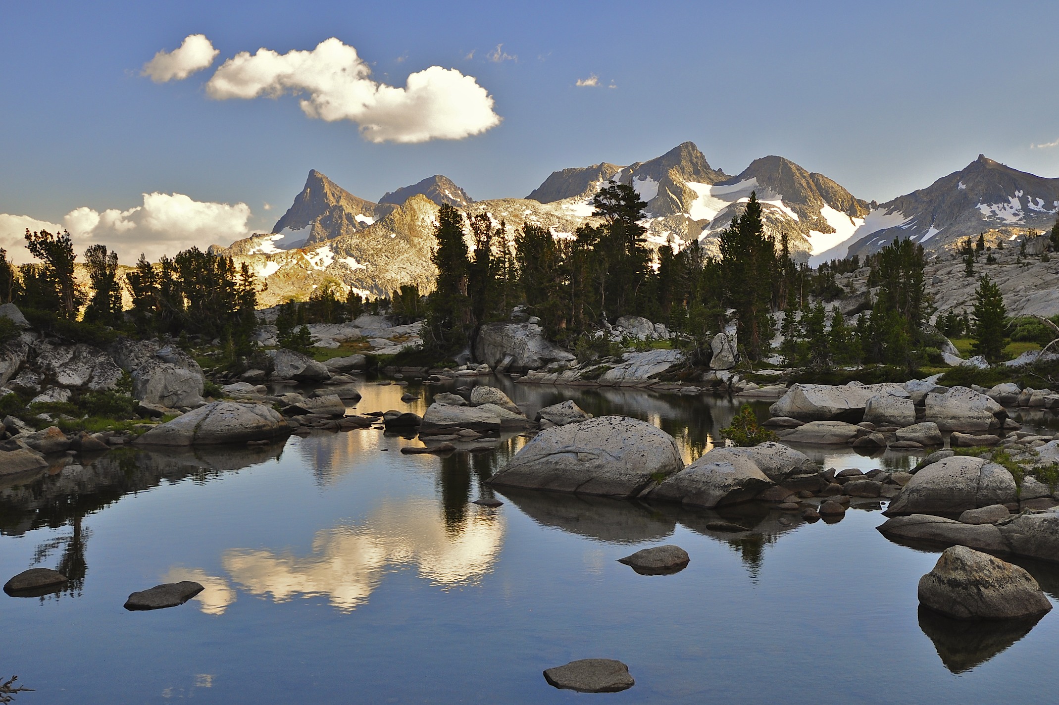
English: This was taken late in the afternoon after crossing Donahue Pass southbound into the Ansel Adams Wilderness on the John Muir Trail. This 5 mile stretch is the only section of the Muir Trail east of the Sierra Crest - everything here drains into Mono Lake |
| Date | Taken on 25 August 2010, 17:00 |
| Source | Ritter Range, Ansel Adams Wilderness |
| Author | Steve Dunleavy from Lake Tahoe, NV, United States |
Licensing edit
This file is licensed under the Creative Commons Attribution 2.0 Generic license.
- You are free:
- to share – to copy, distribute and transmit the work
- to remix – to adapt the work
- Under the following conditions:
- attribution – You must give appropriate credit, provide a link to the license, and indicate if changes were made. You may do so in any reasonable manner, but not in any way that suggests the licensor endorses you or your use.
| This image, originally posted to Flickr, was reviewed on 28 June 2012 by the administrator or reviewer File Upload Bot (Magnus Manske), who confirmed that it was available on Flickr under the stated license on that date. |
File history
Click on a date/time to view the file as it appeared at that time.
| Date/Time | Thumbnail | Dimensions | User | Comment | |
|---|---|---|---|---|---|
| current | 10:12, 28 June 2012 | | 2,139 × 1,424 (767 KB) | File Upload Bot (Magnus Manske) (talk | contribs) | Transferred from Flickr by User:Hike395 using flickr2commons |
You cannot overwrite this file.
File usage on Commons
There are no pages that use this file.
File usage on other wikis
The following other wikis use this file:
- Usage on arz.wikipedia.org
- Usage on ceb.wikipedia.org
- Usage on en.wikipedia.org
- Usage on nl.wikipedia.org
- Usage on www.wikidata.org