File:River Lengarica with Ura e Kadiut and Mount Nemërçka 01.jpg
![File:River Lengarica with Ura e Kadiut and Mount Nemërçka 01.jpg](https://upload.wikimedia.org/wikipedia/commons/thumb/d/d7/River_Lengarica_with_Ura_e_Kadiut_and_Mount_Nem%C3%ABr%C3%A7ka_01.jpg/800px-River_Lengarica_with_Ura_e_Kadiut_and_Mount_Nem%C3%ABr%C3%A7ka_01.jpg?20141011130031)
Original file (3,000 × 2,006 pixels, file size: 2.38 MB, MIME type: image/jpeg)
Captions
Captions
Summary
editDescriptionRiver Lengarica with Ura e Kadiut and Mount Nemërçka 01.jpg |
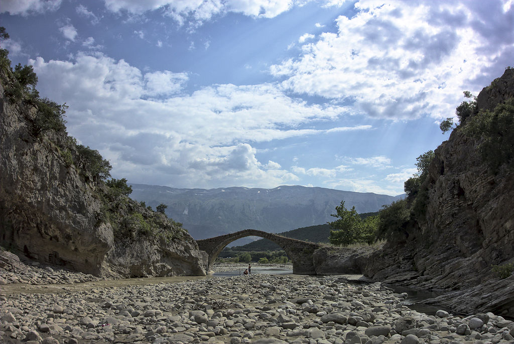
Shqip: Ura Ne Përroin e Benjës (Ura e Kadiut), Lumi Lengarica e Mali Nemërçka English: River Lengarica with bridge "Ura e Kadiut" and Mount Nemërçka Deutsch: Fluss Lengarica mit Brücke "Ura e Kadiut" und Berg Nemërçka
|
||
Date | |||
Source | Own work | ||
Author | Malenki |
Camera location | 40° 14′ 41″ N, 20° 25′ 58.54″ E ![]() | View this and other nearby images on: OpenStreetMap | ![]() |
---|
source name: dscRX009909_Fluss_Lengariça_mit_Anglern,_Brücke_Ura_e_Kadiut_und_Berg_Nemërçka_ok.jpg
Licensing
edit![w:en:Creative Commons](https://upload.wikimedia.org/wikipedia/commons/thumb/7/79/CC_some_rights_reserved.svg/90px-CC_some_rights_reserved.svg.png)
![attribution](https://upload.wikimedia.org/wikipedia/commons/thumb/1/11/Cc-by_new_white.svg/24px-Cc-by_new_white.svg.png)
![share alike](https://upload.wikimedia.org/wikipedia/commons/thumb/d/df/Cc-sa_white.svg/24px-Cc-sa_white.svg.png)
- You are free:
- to share – to copy, distribute and transmit the work
- to remix – to adapt the work
- Under the following conditions:
- attribution – You must give appropriate credit, provide a link to the license, and indicate if changes were made. You may do so in any reasonable manner, but not in any way that suggests the licensor endorses you or your use.
- share alike – If you remix, transform, or build upon the material, you must distribute your contributions under the same or compatible license as the original.
![]() |
This image was uploaded as part of Wiki Loves Monuments 2014.
Afrikaans ∙ Alemannisch ∙ العربية ∙ جازايرية ∙ azərbaycanca ∙ Bikol Central ∙ беларуская ∙ беларуская (тарашкевіца) ∙ български ∙ বাংলা ∙ brezhoneg ∙ bosanski ∙ català ∙ čeština ∙ Cymraeg ∙ dansk ∙ Deutsch ∙ Zazaki ∙ Ελληνικά ∙ English ∙ Esperanto ∙ español ∙ eesti ∙ euskara ∙ فارسی ∙ suomi ∙ français ∙ Frysk ∙ Gaeilge ∙ galego ∙ עברית ∙ हिन्दी ∙ hrvatski ∙ magyar ∙ հայերեն ∙ Bahasa Indonesia ∙ Ido ∙ italiano ∙ 日本語 ∙ ქართული ∙ 한국어 ∙ кыргызча ∙ Lëtzebuergesch ∙ latviešu ∙ Malagasy ∙ македонски ∙ മലയാളം ∙ Bahasa Melayu ∙ Malti ∙ norsk bokmål ∙ नेपाली ∙ Nederlands ∙ norsk nynorsk ∙ norsk ∙ polski ∙ português ∙ português do Brasil ∙ română ∙ русский ∙ sicilianu ∙ davvisámegiella ∙ slovenčina ∙ slovenščina ∙ shqip ∙ српски / srpski ∙ svenska ∙ ไทย ∙ Tagalog ∙ Türkçe ∙ українська ∙ اردو ∙ Yorùbá ∙ 中文 ∙ 中文(中国大陆) ∙ 中文(简体) ∙ 中文(繁體) ∙ 中文(香港) ∙ 中文(臺灣) ∙ +/− |
![]() |
File history
Click on a date/time to view the file as it appeared at that time.
Date/Time | Thumbnail | Dimensions | User | Comment | |
---|---|---|---|---|---|
current | 13:00, 11 October 2014 | ![]() | 3,000 × 2,006 (2.38 MB) | Malenki (talk | contribs) | User created page with UploadWizard |
You cannot overwrite this file.
File usage on Commons
The following page uses this file:
Metadata
This file contains additional information such as Exif metadata which may have been added by the digital camera, scanner, or software program used to create or digitize it. If the file has been modified from its original state, some details such as the timestamp may not fully reflect those of the original file. The timestamp is only as accurate as the clock in the camera, and it may be completely wrong.
Camera manufacturer | SONY |
---|---|
Camera model | DSC-RX100 |
Exposure time | 1/800 sec (0.00125) |
F-number | f/8 |
ISO speed rating | 125 |
Date and time of data generation | 16:09, 18 July 2013 |
Lens focal length | 10.4 mm |
Latitude | 40° 14′ 41″ N |
Longitude | 20° 25′ 58.54″ E |
Altitude | 368.2 meters above sea level |
JPEG file comment | |
Orientation | Normal |
Horizontal resolution | 300 dpi |
Vertical resolution | 300 dpi |
Software used | darktable 1.5+1506~g8c97cf9 |
File change date and time | 14:18, 11 October 2014 |
Y and C positioning | Centered |
Exposure Program | Normal program |
Exif version | 2.3 |
Date and time of digitizing | 16:09, 18 July 2013 |
Meaning of each component |
|
APEX brightness | 11.21640625 |
APEX exposure bias | 0 |
Maximum land aperture | 1.6959938168234 APEX (f/1.8) |
Metering mode | Center weighted average |
Light source | Unknown |
Supported Flashpix version | 1 |
Color space | Uncalibrated |
File source | Digital still camera |
Scene type | A directly photographed image |
Custom image processing | Normal process |
Exposure mode | Auto exposure |
White balance | Auto white balance |
Digital zoom ratio | 1 |
Focal length in 35 mm film | 28 mm |
Scene capture type | Standard |
Contrast | Normal |
Saturation | Normal |
Sharpness | Normal |
GPS time (atomic clock) | 14:09 |
Geodetic survey data used | WGS-84 |
GPS date | 18 July 2013 |
GPS tag version | 0.0.0.2 |
Image compression mode | 8 |
Flash | Flash did not fire, compulsory flash suppression |
Bits per component |
|
Height | 3,672 px |
Width | 5,492 px |
Pixel composition | RGB |
Number of components | 3 |
Rating (out of 5) | 0 |