File:Rocky Ford Crossing Lamb County Texas 2002.jpg
Size of this preview: 800 × 596 pixels. Other resolutions: 320 × 238 pixels | 640 × 476 pixels | 1,024 × 762 pixels | 1,260 × 938 pixels.
Original file (1,260 × 938 pixels, file size: 791 KB, MIME type: image/jpeg)
Captions
Captions
Add a one-line explanation of what this file represents
Summary
edit
| Description |
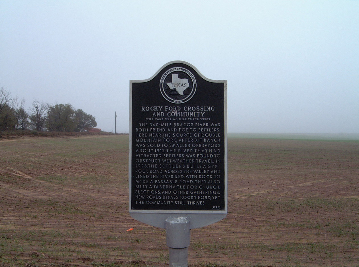
English: Rocky Ford Crossing, a caliche lined road that crossed Blackwater Draw -- once a spring-fed tributary of the North Fork Double Mountain Fork Brazos River, now completely dry due to the depletion of the Ogallala Aquifer. |
| Date | |
| Source | Own work |
| Author | Leaflet |
| Other versions | Public domain photos of the Llano Estacado |
| Camera location | | View this and other nearby images on: OpenStreetMap |
|---|
Licensing
edit
| I, the copyright holder of this work, release this work into the public domain. This applies worldwide. In some countries this may not be legally possible; if so: I grant anyone the right to use this work for any purpose, without any conditions, unless such conditions are required by law. |
File history
Click on a date/time to view the file as it appeared at that time.
| Date/Time | Thumbnail | Dimensions | User | Comment | |
|---|---|---|---|---|---|
| current | 02:17, 10 March 2010 | | 1,260 × 938 (791 KB) | Leaflet (talk | contribs) | {{Information |Description={{en|1=Rocky Ford Crossing, a caliche lined road that crossed {{w|Blackwater Draw}} -- once a spring-fed tributary of the North Fork Double Mountain Fork Brazos River, now completely dry due to the depletion of the {{w|Ogallala |
You cannot overwrite this file.
File usage on Commons
There are no pages that use this file.