File:Rokycany RO CZ.png

Size of this preview: 484 × 600 pixels. Other resolutions: 194 × 240 pixels | 387 × 480 pixels | 702 × 870 pixels.
Original file (702 × 870 pixels, file size: 46 KB, MIME type: image/png)
Captions
Captions
Add a one-line explanation of what this file represents
| Description |
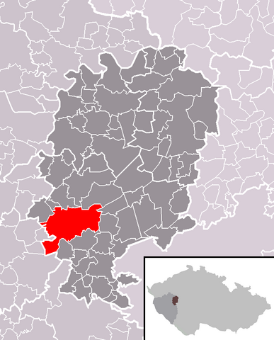
Čeština: Poloha města Rokycany v rámci okresu Rokycany a s ním rozsahem totožného správního obvodu obce s rozšířenou působností Rokycany.
English: Location of Rokycany town within Rokycany District and identical administrative area of Rokycany as a Municipality with Extended Competence. |
||
| Date | |||
| Source | Self made, based on File:Rokycany District 2010 RO CZ.png and File:Map CZ - district Rokycany.PNG | ||
| Author | User:Miaow Miaow | ||
| Permission (Reusing this file) |
|
||
| Other versions |
|

File history
Click on a date/time to view the file as it appeared at that time.
| Date/Time | Thumbnail | Dimensions | User | Comment | |
|---|---|---|---|---|---|
| current | 21:51, 14 March 2010 | | 702 × 870 (46 KB) | Miaow Miaow (talk | contribs) | {{Information |Description={{cs|Poloha města '''Rokycany''' v rámci okresu Rokycany a s ním rozsahem totožného správního obvodu obce s rozšířenou působností Rokycany.}} {{en|Location of '''Rokycany''' town |
You cannot overwrite this file.
File usage on Commons
The following 21 pages use this file:
- Category:Artists from Rokycany
- Category:Births in Rokycany
- Category:Bridges in Rokycany
- Category:Burials in Rokycany
- Category:Businesspeople from Rokycany
- Category:Cemeteries in Rokycany
- Category:Clergy from Rokycany
- Category:Companies of Rokycany
- Category:Culture of Rokycany
- Category:Deaths in Rokycany
- Category:Economy of Rokycany
- Category:History of Rokycany
- Category:Maps of Rokycany
- Category:Organizations of Rokycany
- Category:Religion in Rokycany
- Category:Rokycany
- Category:Sculptures in Rokycany
- Category:Sports in Rokycany
- Category:Structures in Rokycany
- Category:Transport in Rokycany
- Category:Views of Rokycany
File usage on other wikis
The following other wikis use this file:
- Usage on ar.wikipedia.org
- Usage on arz.wikipedia.org
- Usage on ceb.wikipedia.org
- Usage on cs.wikipedia.org
- Usage on de.wikipedia.org
- Usage on eo.wikipedia.org
- Usage on es.wikipedia.org
- Usage on eu.wikipedia.org
- Usage on fa.wikipedia.org
- Usage on fr.wikipedia.org
- Usage on it.wikipedia.org
- Usage on lmo.wikipedia.org
- Usage on pt.wikipedia.org
- Usage on ru.wikipedia.org
- Usage on sk.wikipedia.org
- Usage on sv.wikipedia.org
- Usage on vi.wikipedia.org
- Usage on www.wikidata.org
- Usage on zh-min-nan.wikipedia.org