File:Romania Brasov Location map physical.png
No higher resolution available.
Romania_Brasov_Location_map_physical.png (400 × 338 pixels, file size: 103 KB, MIME type: image/png)
Captions
Captions
Add a one-line explanation of what this file represents
Summary
edit
| Description |
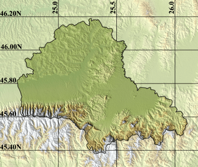
English: Location map of Braşov County Romania (physical) |
| Date | |
| Source | File:Romania_Brasov_Location_map.GIF |
| Author | Asybaris01 |
Licensing
edit
This file is licensed under the Creative Commons Attribution 3.0 Unported license.
- You are free:
- to share – to copy, distribute and transmit the work
- to remix – to adapt the work
- Under the following conditions:
- attribution – You must give appropriate credit, provide a link to the license, and indicate if changes were made. You may do so in any reasonable manner, but not in any way that suggests the licensor endorses you or your use.
File history
Click on a date/time to view the file as it appeared at that time.
| Date/Time | Thumbnail | Dimensions | User | Comment | |
|---|---|---|---|---|---|
| current | 22:00, 5 January 2013 | | 400 × 338 (103 KB) | Matma Rex (talk | contribs) | User created page with UploadWizard |
You cannot overwrite this file.
File usage on Commons
There are no pages that use this file.
File usage on other wikis
The following other wikis use this file:
- Usage on fr.wikipedia.org
- Usage on he.wikipedia.org
- Usage on hu.wikipedia.org
- Nagysinki erődtemplom
- Felméri erődtemplom
- Szászhermányi erődtemplom
- Mirkvásári erődtemplom
- Bálványkő
- Hétlétrák
- Clăbucetul Taurului
- Medveszakadék
- Hasadtkő
- Keresztényfalvi erődtemplom
- Lempes
- Sablon:Pozíciós térkép Brassó megye
- Rozsnyói-barlang
- Arany-lik
- Leánykahavas
- Diákemlékmű (Barcaföldvár)
- Szentháromság-templom (Vidombák)
- Vidombáki erődtemplom
- Nepomuki Szent János-kápolna (Alsótömös)
- Istenszülő elszenderedése templom (Keresztényfalva)
- Szászhermányi láp
- Rádosi erődtemplom
- Boldogvárosi erődtemplom
- Báránykúti erődtemplom
- Nádpataki erődtemplom
- Sárosi erődtemplom
- Höltövényi erődtemplom
- Szent arkangyalok templom (Höltövény)
- Kisprázsmári erődtemplom
- Usage on ja.wikipedia.org
- Usage on pl.wikipedia.org
- Usage on pl.wikibooks.org