File:Route de l'Atlantique en norvège.jpg

Size of this preview: 800 × 599 pixels. Other resolutions: 320 × 240 pixels | 640 × 479 pixels | 1,024 × 767 pixels | 1,280 × 959 pixels | 2,560 × 1,917 pixels | 4,048 × 3,032 pixels.
Original file (4,048 × 3,032 pixels, file size: 12.68 MB, MIME type: image/jpeg)
Captions
Captions
Add a one-line explanation of what this file represents
Summary edit
| Description |
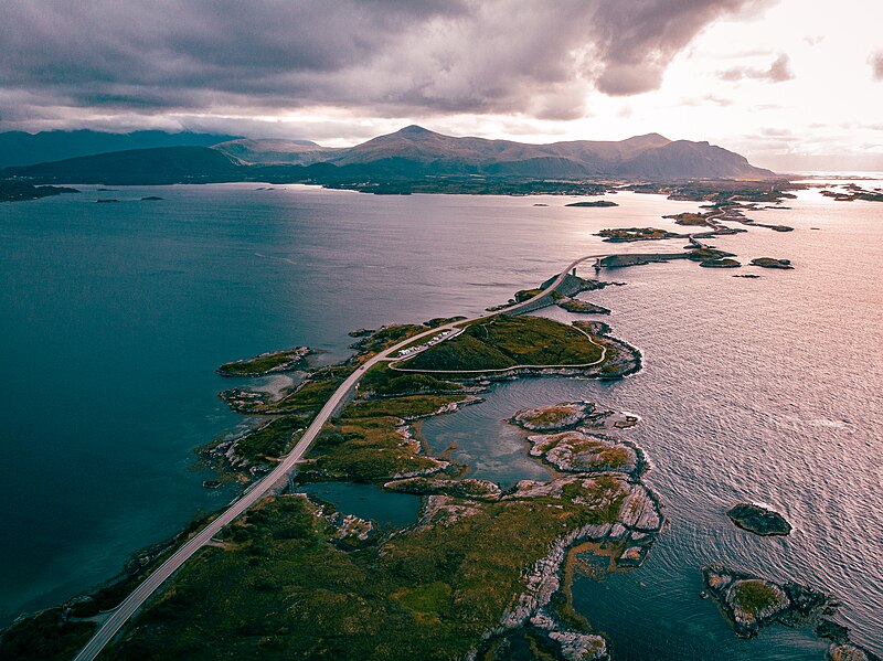
English: Eastern part (aerial view to the south-west) of the Atlantique Road (Atlanterhavsvegen) in Norway, linking small coastal islands to the continent via several bridges and dams, between the villages of Kårvåg (not visible here) and Groravika (visible in the background): a large fjord extends to the left, the Norwegian Sea bordering the Northern Atlantic Ocean is on the right. Français : Partie orientale (vue aérienne en direction du sud-ouest) de la route de l'Atlantique (Atlanterhavsvegen) en Norvège, reliant de petites îles côtières au continent par plusieurs ponts et barrages, entre les villages de Kårvåg (non visible ici) et Groravika (visible dans le fond): un large fjord s'étend à gauche, la Mer de Norvège bordant l'Océan Atlantique Nord est à droite. |
| Date | |
| Source | Own work |
| Author | Clementp.fr |
| Camera location | | View this and other nearby images on: OpenStreetMap |
|---|
Licensing edit
I, the copyright holder of this work, hereby publish it under the following license:
This file is licensed under the Creative Commons Attribution-Share Alike 4.0 International license.
- You are free:
- to share – to copy, distribute and transmit the work
- to remix – to adapt the work
- Under the following conditions:
- attribution – You must give appropriate credit, provide a link to the license, and indicate if changes were made. You may do so in any reasonable manner, but not in any way that suggests the licensor endorses you or your use.
- share alike – If you remix, transform, or build upon the material, you must distribute your contributions under the same or compatible license as the original.
File history
Click on a date/time to view the file as it appeared at that time.
| Date/Time | Thumbnail | Dimensions | User | Comment | |
|---|---|---|---|---|---|
| current | 08:34, 16 June 2023 | | 4,048 × 3,032 (12.68 MB) | Clementp1986 (talk | contribs) | Uploaded own work with UploadWizard |
You cannot overwrite this file.
File usage on Commons
The following page uses this file:
File usage on other wikis
The following other wikis use this file:
- Usage on fr.wikipedia.org