File:Route of the dismantled railway - geograph.org.uk - 685283.jpg
No higher resolution available.
Route_of_the_dismantled_railway_-_geograph.org.uk_-_685283.jpg (640 × 480 pixels, file size: 91 KB, MIME type: image/jpeg)
Captions
Captions
Add a one-line explanation of what this file represents
Summary
edit
| Description |
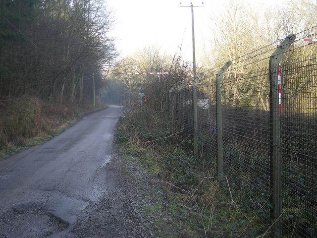
English: Route of the dismantled railway The roadway is laid over the route of railway line that ran from Bridgnorth to Shrewsbury. Now part of the Severn Way long distance footpath it continues as far as the power station just west of Ironbridge. The place seems to be almost always in shade due to the steep & high bank to the south and south-west. This section of path is not particularly nice as it passes the local sewage works which can at times have a presence all of their own. |
| Date | |
| Source | From geograph.org.uk |
| Author | Row17 |
| Attribution (required by the license) | Row17 / Route of the dismantled railway / |
| Camera location | | View this and other nearby images on: OpenStreetMap |
|---|
_heading:157.00&language=en)
| Object location | | View this and other nearby images on: OpenStreetMap |
|---|
_heading:157.00&language=en)
Licensing
edit

|
This image was taken from the Geograph project collection. See this photograph's page on the Geograph website for the photographer's contact details. The copyright on this image is owned by Row17 and is licensed for reuse under the Creative Commons Attribution-ShareAlike 2.0 license.
|
This file is licensed under the Creative Commons Attribution-Share Alike 2.0 Generic license.
Attribution: Row17
- You are free:
- to share – to copy, distribute and transmit the work
- to remix – to adapt the work
- Under the following conditions:
- attribution – You must give appropriate credit, provide a link to the license, and indicate if changes were made. You may do so in any reasonable manner, but not in any way that suggests the licensor endorses you or your use.
- share alike – If you remix, transform, or build upon the material, you must distribute your contributions under the same or compatible license as the original.
File history
Click on a date/time to view the file as it appeared at that time.
| Date/Time | Thumbnail | Dimensions | User | Comment | |
|---|---|---|---|---|---|
| current | 02:36, 8 February 2011 | | 640 × 480 (91 KB) | GeographBot (talk | contribs) | == {{int:filedesc}} == {{Information |description={{en|1=Route of the dismantled railway The roadway is laid over the route of railway line that ran from Bridgnorth to Shrewsbury. Now part of the Severn Way long distance footpath it continues as far as th |
You cannot overwrite this file.
File usage on Commons
There are no pages that use this file.