File:Rupeltongrube Bad Freienwalde.jpg

Size of this preview: 800 × 532 pixels. Other resolutions: 320 × 213 pixels | 640 × 425 pixels | 1,024 × 680 pixels | 1,280 × 850 pixels | 2,560 × 1,701 pixels | 4,672 × 3,104 pixels.
Original file (4,672 × 3,104 pixels, file size: 12.28 MB, MIME type: image/jpeg)
Captions
Captions
Add a one-line explanation of what this file represents
Summary
edit
| Description |
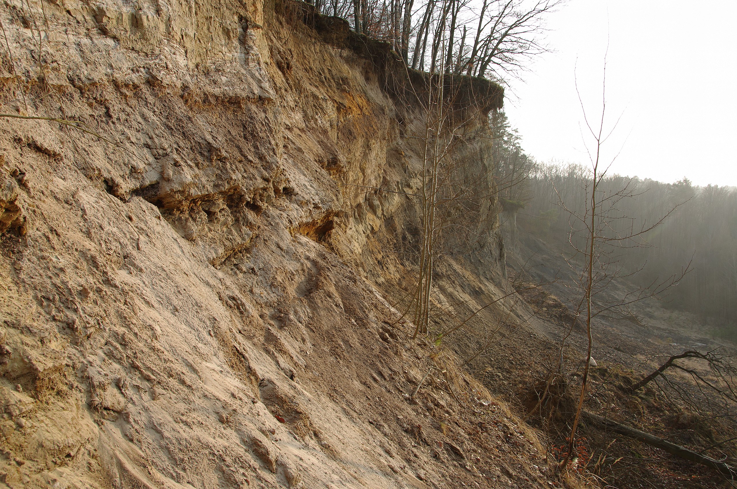
Deutsch: Im Stauchendmoränenkomplex bei Bad Freienwalde (Ostbrandenburg, Lkr. Märkisch-Oderland) wurden tertiäre Sedimente oberflächennah aufgeschoben und durch Bergbau (Tonabbau) aufgeschlossen. In der inzwischen aufgegebenen Grube lassen sich seltene Mineralien und Fossilien finden. Sie liegt innerhalb des LSG "Bad Freienwalde (Waldkomplex)". |
| Date | |
| Source | Own work |
| Author | Ar Herrmann |
| Camera location | | View this and other nearby images on: OpenStreetMap |
|---|
http://kanalmusik.de/wordpress%202/?p=1029
Licensing
edit
I, the copyright holder of this work, hereby publish it under the following license:
This file is licensed under the Creative Commons Attribution-Share Alike 4.0 International license.
- You are free:
- to share – to copy, distribute and transmit the work
- to remix – to adapt the work
- Under the following conditions:
- attribution – You must give appropriate credit, provide a link to the license, and indicate if changes were made. You may do so in any reasonable manner, but not in any way that suggests the licensor endorses you or your use.
- share alike – If you remix, transform, or build upon the material, you must distribute your contributions under the same or compatible license as the original.
This image was uploaded as part of Wiki Loves Earth 2017.
|
 |
File history
Click on a date/time to view the file as it appeared at that time.
| Date/Time | Thumbnail | Dimensions | User | Comment | |
|---|---|---|---|---|---|
| current | 18:36, 29 May 2017 | | 4,672 × 3,104 (12.28 MB) | Ar Herrmann (talk | contribs) | User created page with UploadWizard |
You cannot overwrite this file.
File usage on Commons
The following 2 pages use this file:
File usage on other wikis
The following other wikis use this file:
- Usage on de.wikipedia.org
- Usage on www.wikidata.org