File:Russia Sakha Republic locator map.png

Size of this preview: 598 × 600 pixels. Other resolutions: 239 × 240 pixels | 479 × 480 pixels | 702 × 704 pixels.
Original file (702 × 704 pixels, file size: 29 KB, MIME type: image/png)
Captions
Captions
Add a one-line explanation of what this file represents

|
File:Yakutia notext.svg is a vector version of this file. It should be used in place of this PNG file when not inferior.
File:Russia Sakha Republic locator map.png → File:Yakutia notext.svg
For more information, see Help:SVG. |
 |
Summary edit
| Description |
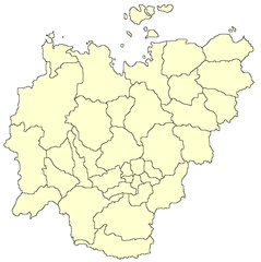
English: Locator map of Sakha Republic
Русский: Позиционная карта Республики Саха (Якутия) |
| Date | 4 October 2008 (upload date) |
| Source | Own work |
| Author | Denhud |
Licensing edit
| I, the copyright holder of this work, release this work into the public domain. This applies worldwide. In some countries this may not be legally possible; if so: I grant anyone the right to use this work for any purpose, without any conditions, unless such conditions are required by law. |
File history
Click on a date/time to view the file as it appeared at that time.
| Date/Time | Thumbnail | Dimensions | User | Comment | |
|---|---|---|---|---|---|
| current | 15:58, 4 October 2008 | | 702 × 704 (29 KB) | Denhud (talk | contribs) | {{Information |Description={{en|1=Locator map of Sakha Republic}} {{ru|1=Позиционная карта Республики Саха (Якутия)}} |Source=Own work by uploader |Author=Denhud |Date=4.10.2008 |Permission= |other_versi |
You cannot overwrite this file.
File usage on Commons
There are no pages that use this file.
File usage on other wikis
The following other wikis use this file:
- Usage on de.wikipedia.org