File:Russia political location map (Crimea disputed).svg

Size of this PNG preview of this SVG file: 800 × 451 pixels. Other resolutions: 320 × 181 pixels | 640 × 361 pixels | 1,024 × 578 pixels | 1,280 × 722 pixels | 2,560 × 1,444 pixels | 2,136 × 1,205 pixels.
Original file (SVG file, nominally 2,136 × 1,205 pixels, file size: 921 KB)
Captions
Captions
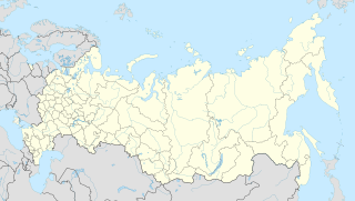
Political location map of Russia with Crimea and South Kuril Islands shown as disputed territory
| Description |
English: Political location map of Russia (Crimea highlighted)
Русский: Позиционная политическая карта России (Крым выделен цветом) |
| Date | |
| Source | Own, based on File:Russia political location map.svg |
| Author |
Hellerick (original) Crimea colored by Seryo93 |
| Permission (Reusing this file) |
I, the copyright holder of this work, hereby publish it under the following license: This file is licensed under the Creative Commons Attribution-Share Alike 4.0 International license.
|
| Other versions |
|

File history
Click on a date/time to view the file as it appeared at that time.
.svg&dir=prev)
.svg&offset=20151105165525)
.svg&offset=&limit=20)
.svg&offset=&limit=50)
.svg&offset=&limit=100)
.svg&offset=&limit=250)
.svg&offset=&limit=500)
| Date/Time | Thumbnail | Dimensions | User | Comment | |
|---|---|---|---|---|---|
| current | 11:13, 26 May 2020 | | 2,136 × 1,205 (921 KB) | Seryo93 (talk | contribs) | More lightweight |
| 10:21, 21 January 2020 |  | 2,136 × 1,205 (1.44 MB) | Takhirgeran Umar (talk | contribs) | clarification | |
| 16:17, 18 October 2017 |  | 2,136 × 1,205 (1.44 MB) | Seryo93 (talk | contribs) | Replaced with hatching version | |
| 22:39, 9 January 2017 |  | 2,136 × 1,205 (1.45 MB) | Stasyan117 (talk | contribs) | Reverted to version as of 16:29, 5 January 2017 (UTC) | |
| 22:35, 9 January 2017 |  | 2,136 × 1,205 (1.45 MB) | Stasyan117 (talk | contribs) | Reverted to version as of 22:28, 2 June 2016 (UTC) | |
| 16:29, 5 January 2017 |  | 2,136 × 1,205 (1.45 MB) | Stasyan117 (talk | contribs) | Reverted to version as of 22:38, 2 June 2016 (UTC) | |
| 16:16, 5 January 2017 |  | 2,136 × 1,205 (1.45 MB) | Stasyan117 (talk | contribs) | Reverted to version as of 22:28, 2 June 2016 (UTC) | |
| 22:38, 2 June 2016 |  | 2,136 × 1,205 (1.45 MB) | Stasyan117 (talk | contribs) | Reverted to version as of 16:55, 5 November 2015 (UTC) | |
| 22:28, 2 June 2016 |  | 2,136 × 1,205 (1.45 MB) | Stasyan117 (talk | contribs) | fix | |
| 16:55, 5 November 2015 |  | 2,136 × 1,205 (1.45 MB) | Seryo93 (talk | contribs) | minor code cleanup |
You cannot overwrite this file.
File usage on Commons
The following 3 pages use this file:
File usage on other wikis
The following other wikis use this file:
- Usage on alt.wikipedia.org
- Јаан Јаламан
- Јаан Чаргы
- Јабаган
- Јабаган-Бажы
- Јазулу
- Јайлу
- Јалаҥай
- Јалаҥый-Бажы
- Јар-Айыл
- Јаҥы-Аул
- Јаҥы Белтир
- Јекјийек
- Јодралу
- Јодро
- Јоло
- Јыланду
- Јӱс Тыт
- Абай (Кӧксу-Оозы аймак)
- Ай-Балык
- Айты-Коол
- Айулу
- Ак-Боом
- Ак-Кобы
- Ак-Сас
- Ак-Тал
- Акташ
- Акјул
- Ала-Кайыҥ
- Алтыгы-Кубее
- Алтыгы-Оймон
- Алтыгы Куйум
- Алтыгы Талду
- Амыр (Кӧксу-Оозы аймак)
- Апшыйакты
- Арбайты
- Аркыт
- Артыбаш
- Ары-Мыйту
- Аскат
- Бабырган
- Байгол
- Балыкту Јул
- Балыкчы
- Бараан-Коол
- Барагаш
- Барлак
- Бархатово
- Басты-Кем
- Баштаҥул
- Бел-Ажу
View more global usage of this file.
.svg)
.svg&oldid=788641147)