File:Russian Empire 1792 Map.jpg

Size of this preview: 800 × 415 pixels. Other resolutions: 320 × 166 pixels | 640 × 332 pixels | 1,024 × 531 pixels | 1,280 × 664 pixels | 2,560 × 1,327 pixels | 4,321 × 2,240 pixels.
Original file (4,321 × 2,240 pixels, file size: 1.42 MB, MIME type: image/jpeg)
Captions
Captions
Add a one-line explanation of what this file represents
Summary edit
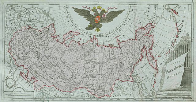
| Description |
Русский: Малоформатный атлас Российской империи (1792). Карта Российской империи (карта 1).
English: Small atlas of the Russian Empire (1792). Map of the Russian Empire (map 1). |
| Date | |
| Source |
Русский: Атлас Российской империи, : Состоящий из 46 карт, : Изданный во граде св. Петра 1792 года / отпечатан не ранее 1793 года. Цифровая копия сделана Российской государственной библиотекой (http://www.rsl.ru)
English: Atlas of the Russian Empire (1792), : Consist of 46 maps, : Published in St. Petersburg (1792) / printed in 1793 or later. Digital copy made by Russian State Library (http://www.rsl.ru/en) |
| Author |
Русский: издатель: типография Сытина English: publisher:Sytin's print shop |
| Other versions |
|

.jpg)
Licensing edit
|
This work is in the public domain in its country of origin and other countries and areas where the copyright term is the author's life plus 100 years or fewer. | |
| This file has been identified as being free of known restrictions under copyright law, including all related and neighboring rights. | |
File history
Click on a date/time to view the file as it appeared at that time.
| Date/Time | Thumbnail | Dimensions | User | Comment | |
|---|---|---|---|---|---|
| current | 13:09, 12 December 2009 | | 4,321 × 2,240 (1.42 MB) | Transcend (rus) (talk | contribs) | == {{int:filedesc}} == {{Information |Description= {{ru|Малоформатный атлас Российской империи (1792). Карта Российской империи (лист 2).}} {{en|Small atlas of the Russian Empire (1792). Map of |
You cannot overwrite this file.
File usage on Commons
The following page uses this file:
File usage on other wikis
The following other wikis use this file:
- Usage on ast.wikipedia.org
- Usage on en.wikipedia.org
- Usage on es.wikipedia.org
- Usage on et.wikipedia.org
- Usage on lt.wikipedia.org
- Usage on lt.wikibooks.org
- Usage on lv.wikipedia.org
- Usage on pnb.wikipedia.org
- Usage on ru.wikipedia.org
- Usage on sr.wikipedia.org
- Usage on ur.wikipedia.org
- Usage on vi.wikipedia.org