File:Russo-Turkish War, 1877–1878.jpg

Size of this preview: 732 × 599 pixels. Other resolutions: 293 × 240 pixels | 586 × 480 pixels | 900 × 737 pixels.
Original file (900 × 737 pixels, file size: 126 KB, MIME type: image/jpeg)
Captions
Captions
Add a one-line explanation of what this file represents
| Description |
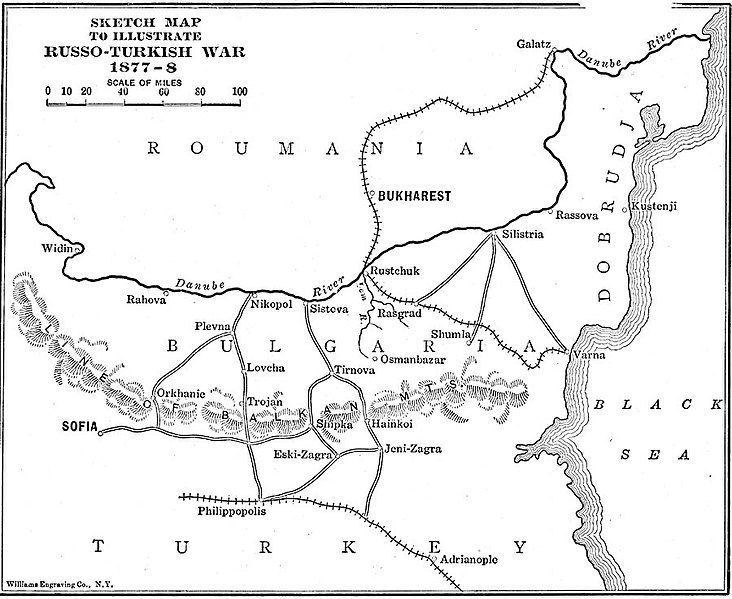
English: A sketch–map to illustrate the Russo–Turkish War, from 1877 to 1878 in the region south of the Danube River Delta in Roumania and Bulgaria. The map shows strategic railways and roads, terrain such as the Balkan Mountain passes and the Danube, and the important cities of Bukharest, Galatz, Nikopol, Rustchuck, Silistria, Sofia, Philippopolis, and Shipka. |
||
| Date | |||
| Source | http://etc.usf.edu/maps/pages/800/866/866.htm | ||
| Author | Lucius Hudson Holt, Ph.D., The History of Europe from 1862 to 1914 (New York, NY: The Macmillan Company) | ||
| Permission (Reusing this file) |
|
File history
Click on a date/time to view the file as it appeared at that time.
| Date/Time | Thumbnail | Dimensions | User | Comment | |
|---|---|---|---|---|---|
| current | 13:24, 16 March 2013 | | 900 × 737 (126 KB) | Gonzosft (talk | contribs) | {{Information |Description ={{en|1=A sketch–map to illustrate the Russo–Turkish War, from 1877 to 1878 in the region south of the Danube River Delta in Roumania and Bulgaria. The map shows strategic railways and roads, terrain such as the Balkan... |
You cannot overwrite this file.
File usage on Commons
There are no pages that use this file.
File usage on other wikis
The following other wikis use this file:
- Usage on cy.wikipedia.org
- Usage on de.wikipedia.org
- Usage on it.wikipedia.org