File:Ruta 23-CH km 58.JPG

Size of this preview: 800 × 600 pixels. Other resolutions: 320 × 240 pixels | 640 × 480 pixels | 1,024 × 768 pixels | 1,280 × 960 pixels | 2,560 × 1,920 pixels | 5,184 × 3,888 pixels.
Original file (5,184 × 3,888 pixels, file size: 6.27 MB, MIME type: image/jpeg)
Captions
Captions
Add a one-line explanation of what this file represents
Summary
edit
| Description |
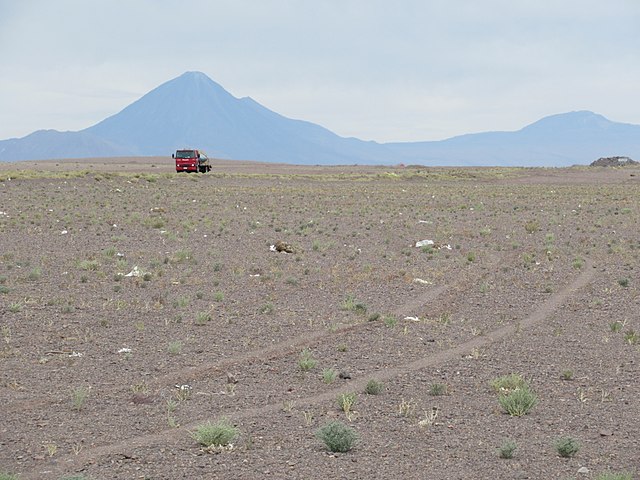
Deutsch: Km 48 Ruta 23-CH, 3418 m ü.M.: Am Weg von Calama nach San Pedro de Atacama beim höchsten Punkt über den Paso Barros Arana durch die Hochebene der Cordillera de Domeyko. Im Hintergrund der Vulkan Licancabur.
Español: Km 48 Ruta 23-CH, 3418 m s.n.m.: En la ruta de Calama a San Pedro de Atacama cercano al punto mas alto por el Paso Barros Arana en la meseta de la Cordillera de Domeyko. Al fondo el volcán Licancabur.
English: Km 48 Ruta 23-CH, 3418 m a.s.l.: At the road from Calama to San Pedro de Atacama near the top of the Paso Barros Arana through the high plain of the Cordillera de Domeyko. Licancabur in the backgound. |
| Date | |
| Source | Own work |
| Author | WeHaKa |
| Permission (Reusing this file) |
This file is licensed under the Creative Commons Attribution-Share Alike 3.0 Unported license. Attribution: WeHaKa
|
| Camera location | | View this and other nearby images on: OpenStreetMap |
|---|
| Annotations | This image is annotated: View the annotations at Commons |
File history
Click on a date/time to view the file as it appeared at that time.
| Date/Time | Thumbnail | Dimensions | User | Comment | |
|---|---|---|---|---|---|
| current | 16:45, 11 February 2018 | | 5,184 × 3,888 (6.27 MB) | WeHaKa (talk | contribs) | {{Information |description = {{de|Km 48 Ruta 23-CH, 3418 m ü.M.: Am Weg von Calama nach San Pedro de Atacama beim höchsten Punkt über den Paso Barros Arana durch die Hochebene der Cordillera de Domeyko. Im Hintergrund der Vulkan Licancabur.}} {{... |
You cannot overwrite this file.
File usage on Commons
There are no pages that use this file.
File usage on other wikis
The following other wikis use this file:
- Usage on de.wikipedia.org
- Usage on es.wikipedia.org