File:Ruta Imperial mapa.svg

Size of this PNG preview of this SVG file: 600 × 600 pixels. Other resolutions: 240 × 240 pixels | 480 × 480 pixels | 768 × 768 pixels | 1,024 × 1,024 pixels | 2,048 × 2,048 pixels | 1,000 × 1,000 pixels.
Original file (SVG file, nominally 1,000 × 1,000 pixels, file size: 457 KB)
Captions
Captions
Add a one-line explanation of what this file represents
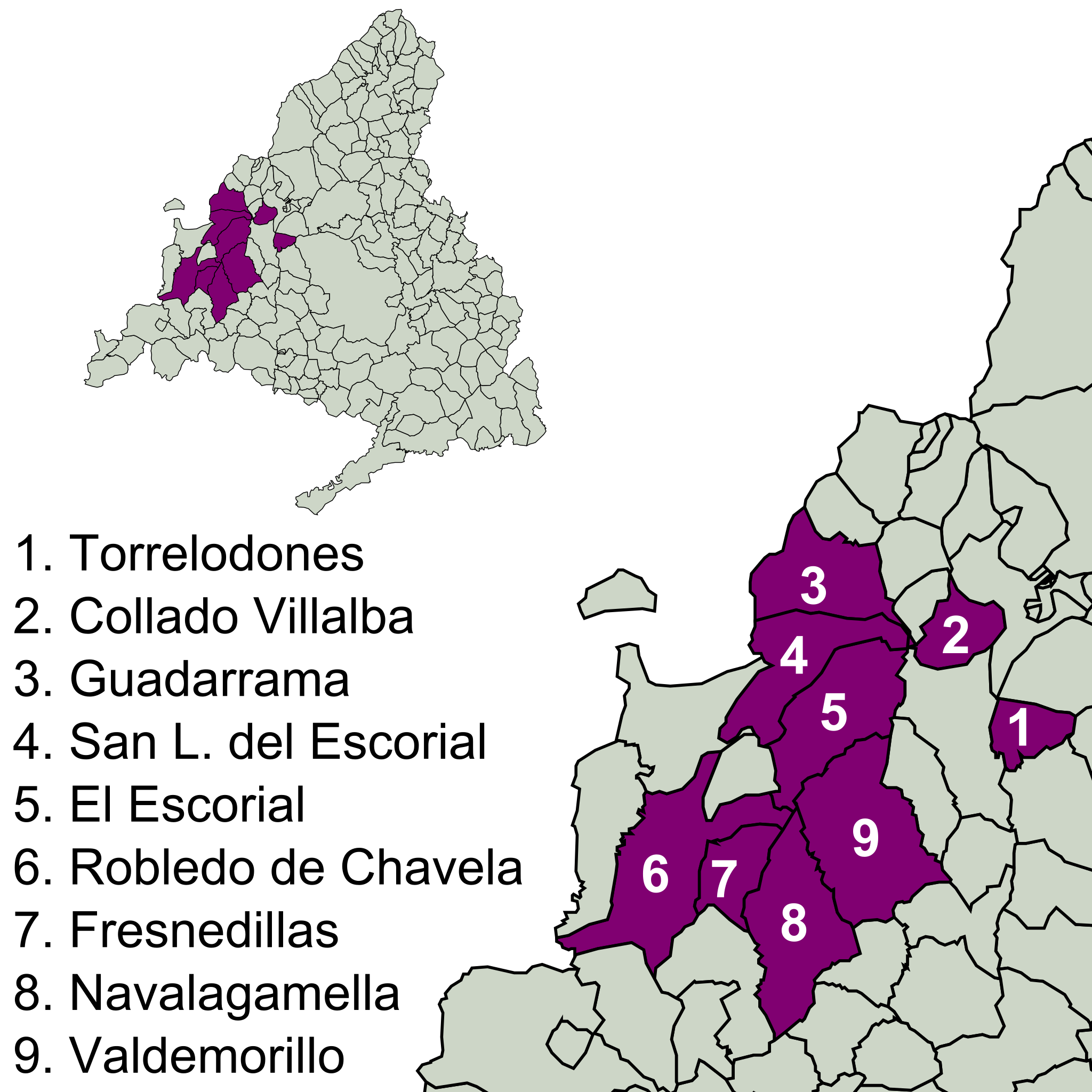
| Description | Ruta Imperial de la Comunidad de Madrid, mapa (SVG) |
| Date | (UTC) |
| Source | |
| Author |
|
| This is a retouched picture, which means that it has been digitally altered from its original version. Modifications: SVG. The original can be viewed here: Ruta Imperial mapa.png:
|
I, the copyright holder of this work, hereby publish it under the following licenses:
This file is licensed under the Creative Commons Attribution 3.0 Unported license.
- You are free:
- to share – to copy, distribute and transmit the work
- to remix – to adapt the work
- Under the following conditions:
- attribution – You must give appropriate credit, provide a link to the license, and indicate if changes were made. You may do so in any reasonable manner, but not in any way that suggests the licensor endorses you or your use.

|
Permission is granted to copy, distribute and/or modify this document under the terms of the GNU Free Documentation License, Version 1.2 or any later version published by the Free Software Foundation; with no Invariant Sections, no Front-Cover Texts, and no Back-Cover Texts. A copy of the license is included in the section entitled GNU Free Documentation License. |
You may select the license of your choice.
Original upload log
edit
This image is a derivative work of the following images:
- File:Ruta_Imperial_mapa.png licensed with Cc-by-3.0, Cc-by-3.0, GFDL, GFDL/en
- 2007-10-04T15:51:50Z Esetena 969x773 (314998 Bytes) {{Information |Description=Ruta Imperial de la Comunidad de Madrid, mapa |Source=self made |Date=oct 4th, 2007 |Author=Esetena |Permission=see bellow |other_versions= }} [[Category:Sierra de Guadarrama]] [[Category:Community
- 2007-10-04T15:34:52Z Esetena 978x740 (270415 Bytes) {{Information |Description=Ruta Imperial de la Comunidad de Madrid, mapa |Source=self-made |Date=Oct 4th, 2007 |Author=Esetena |Permission=yes |other_versions= }} [[Category:Community of Madrid]] [[Category:Sierra de Guadarra
Uploaded with derivativeFX
File history
Click on a date/time to view the file as it appeared at that time.
| Date/Time | Thumbnail | Dimensions | User | Comment | |
|---|---|---|---|---|---|
| current | 17:13, 4 February 2009 | | 1,000 × 1,000 (457 KB) | Phirosiberia (talk | contribs) | {{Information |Description=Ruta Imperial de la Comunidad de Madrid, mapa (SVG) |Source=*File:Ruta_Imperial_mapa.png |Date=2009-02-04 17:11 (UTC) |Author=*File:Ruta_Imperial_mapa.png: Esetena *derivative work: ~~~ |Permission=see below |other_v |
You cannot overwrite this file.
File usage on Commons
The following page uses this file:
File usage on other wikis
The following other wikis use this file:
- Usage on en.wikipedia.org
- Usage on es.wikipedia.org