File:Rwandan Civil War (July 18, 1994).svg

Size of this PNG preview of this SVG file: 680 × 595 pixels. Other resolutions: 274 × 240 pixels | 549 × 480 pixels | 878 × 768 pixels | 1,170 × 1,024 pixels | 2,341 × 2,048 pixels.
Original file (SVG file, nominally 680 × 595 pixels, file size: 251 KB)
Captions
Captions
Add a one-line explanation of what this file represents
Summary edit
.svg&action=edit§ion=1)
| Description |
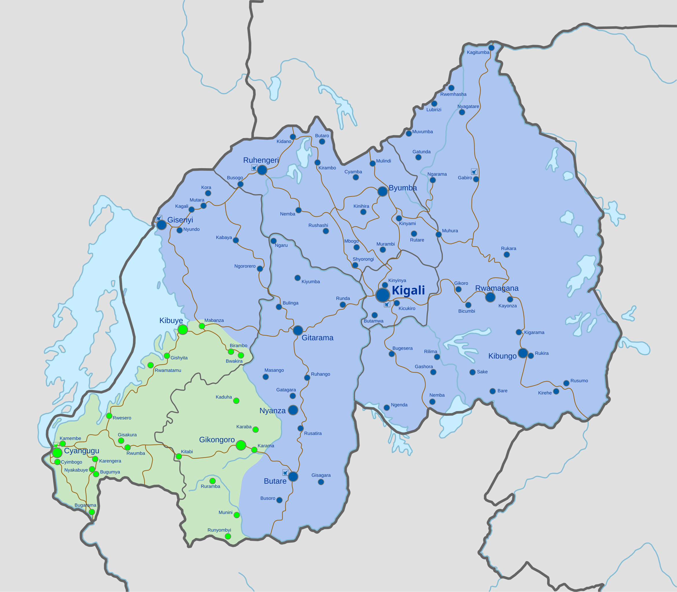
English: Detailed map of Rwanda showing the approximate frontlines during mid-July 1994, after the captures of Butare, Ruhengeri, and Gisenyi.
|
| Date | |
| Source | Own work, derivate of File:Rwanda adm location map.svg |
| Author | Rr016 |
Licensing edit
.svg&action=edit§ion=2)
I, the copyright holder of this work, hereby publish it under the following license:
This file is licensed under the Creative Commons Attribution-Share Alike 4.0 International license.
- You are free:
- to share – to copy, distribute and transmit the work
- to remix – to adapt the work
- Under the following conditions:
- attribution – You must give appropriate credit, provide a link to the license, and indicate if changes were made. You may do so in any reasonable manner, but not in any way that suggests the licensor endorses you or your use.
- share alike – If you remix, transform, or build upon the material, you must distribute your contributions under the same or compatible license as the original.
File history
Click on a date/time to view the file as it appeared at that time.
| Date/Time | Thumbnail | Dimensions | User | Comment | |
|---|---|---|---|---|---|
| current | 20:14, 18 July 2021 | | 680 × 595 (251 KB) | Rr016 (talk | contribs) | Uploaded own work with UploadWizard |
You cannot overwrite this file.
File usage on Commons
The following page uses this file:
.svg&oldid=871512153)