File:SNK MAP I 1000W.jpg
Size of this preview: 800 × 557 pixels. Other resolutions: 320 × 223 pixels | 640 × 446 pixels | 1,024 × 713 pixels | 1,280 × 892 pixels | 1,556 × 1,084 pixels.
Original file (1,556 × 1,084 pixels, file size: 250 KB, MIME type: image/jpeg)
Captions
Captions
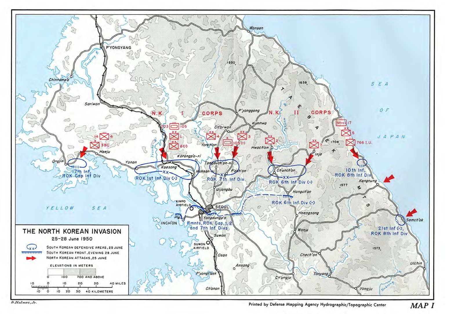
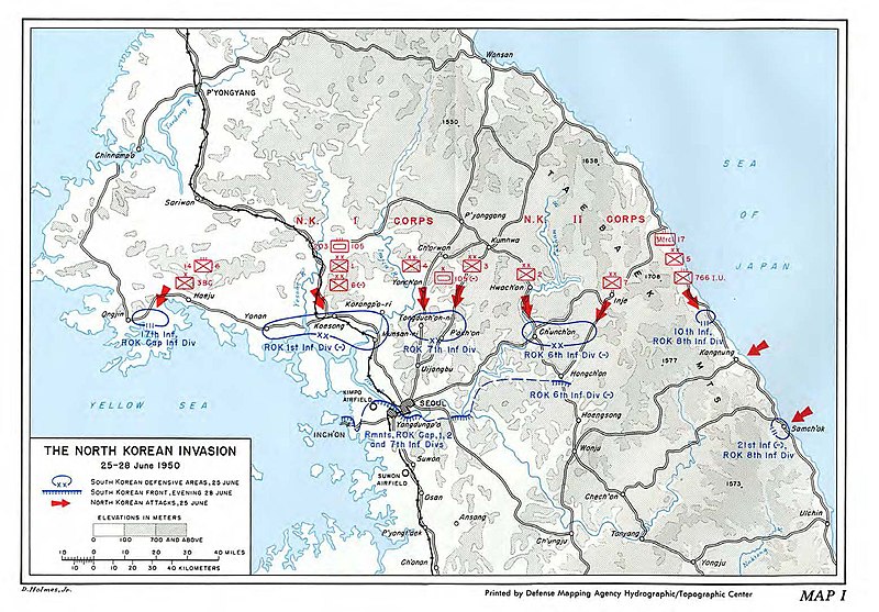
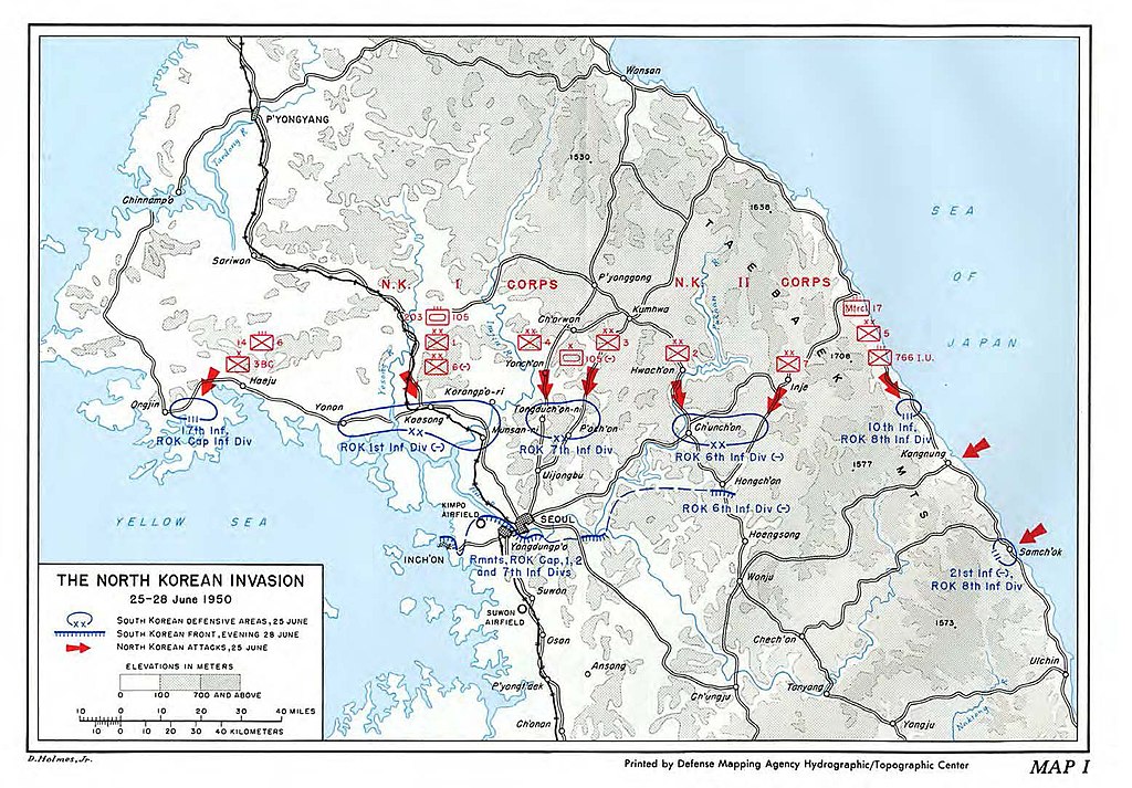
The North Korean Invasion, 25-28 June 1950
Summary edit
| Description |
English: Map of the North Korean Invasion, 25-28 June 1950 |
| Date | |
| Source | South To The Naktong, North To The Yalu - The United States Army in the Korean War, Center of Military History, United States Army, Washington, D.C. |
| Author | Roy E. Appleman |
Licensing edit
| This image is in the public domain because it contains materials that originally came from the United States Army Center of Military History, subject to the following qualification.
Note: The images of all badges, insignia, decorations and medals on the "CMH Online" web site are produced by the United States Army Institute of Heraldry and protected by Title 18, United States Code, Section 704 and the Code of Federal Regulations (32 CFR, Part 507). Permission to use these images for commercial purposes must be obtained from The Institute of Heraldry prior to their use. |

|
File history
Click on a date/time to view the file as it appeared at that time.
| Date/Time | Thumbnail | Dimensions | User | Comment | |
|---|---|---|---|---|---|
| current | 22:26, 28 December 2020 | | 1,556 × 1,084 (250 KB) | Charles Shaulis (talk | contribs) | Uploaded a work by D. Holmes, Jr. from Reference: South To The Naktong, North To The Yalu - The United States Army in the Korean War, Center of Military History, United States Army, Washington, D.C. with UploadWizard |
You cannot overwrite this file.
File usage on Commons
There are no pages that use this file.
File usage on other wikis
The following other wikis use this file:
- Usage on en.wikipedia.org
- Usage on ko.wikipedia.org
- Usage on my.wikipedia.org
- Usage on zh.wikipedia.org