File:SOUTH BELLONA REEF.jpg
Size of this preview: 800 × 533 pixels. Other resolutions: 320 × 213 pixels | 640 × 427 pixels | 1,024 × 683 pixels | 1,280 × 853 pixels | 3,000 × 2,000 pixels.
Original file (3,000 × 2,000 pixels, file size: 402 KB, MIME type: image/jpeg)
Captions
Captions
Add a one-line explanation of what this file represents
Summary edit
| Description |
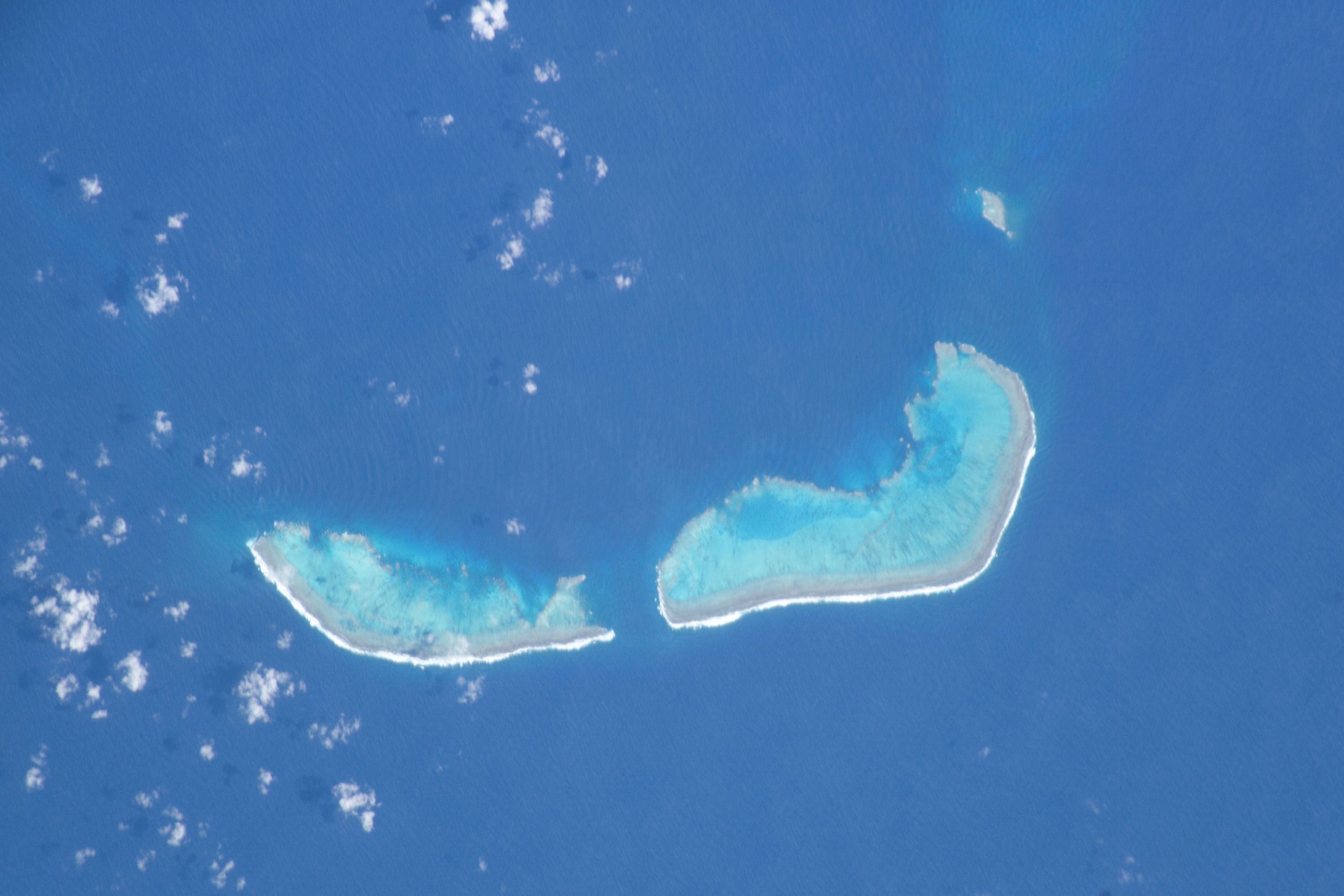
English: Mission: ISS006
CORAL SEA SOUTH BELLONA REEF Center Point Latitude: -22.0 Center Point Longitude: 159.5 Nadir Point Latitude: -22.7, Longitude: 158.8 (Negative numbers indicate south for latitude and west for longitude) Nadir to Photo Center Direction: Northeast Sun Azimuth: 100 (Clockwise angle in degrees from north to the sun measured at the nadir point) Spacecraft Altitude: 215 nautical miles (398 km) Sun Elevation Angle: 50 (Angle in degrees between the horizon and the sun, measured at the nadir point) |
| Date | GMT |
| Source | NASA |
| Author | NASA |
Center Point Latitude: -22.0 Center Point Longitude: 159.5
Licensing edit
This file is in the public domain in the United States because it was created by the Image Science & Analysis Laboratory, of the NASA Johnson Space Center. NASA copyright policy states that "NASA material is not protected by copyright unless noted". (NASA media use guidelines or Conditions of Use of Astronaut Photographs).
Photo source: ISS006-E-7739.
|
| Annotations | This image is annotated: View the annotations at Commons |
File history
Click on a date/time to view the file as it appeared at that time.
| Date/Time | Thumbnail | Dimensions | User | Comment | |
|---|---|---|---|---|---|
| current | 11:00, 20 July 2017 | | 3,000 × 2,000 (402 KB) | Szczureq (talk | contribs) | full resolution sans caption |
| 23:38, 12 December 2008 |  | 639 × 435 (42 KB) | Whodidwhat (talk | contribs) | {{Information |Description={{en|1=Mission: ISS006 CORAL SEA SOUTH BELLONA REEF Center Point Latitude: -22.0 Center Point Longitude: 159.5 Nadir Point Latitude: -22.7, Longitude: 158.8 (Negative numbers indicate south for latitude and west for longitude) N |
You cannot overwrite this file.
File usage on Commons
The following page uses this file:
File usage on other wikis
The following other wikis use this file:
- Usage on de.wikipedia.org
- Usage on en.wikipedia.org
- Usage on ka.wikipedia.org
- Usage on ru.wikipedia.org