File:Saga Tsujinodo Intersection and Shima Pharmacy.jpg
Size of this preview: 800 × 533 pixels. Other resolutions: 320 × 213 pixels | 640 × 427 pixels | 1,024 × 683 pixels | 1,280 × 853 pixels | 2,560 × 1,707 pixels | 3,990 × 2,660 pixels.
Original file (3,990 × 2,660 pixels, file size: 2.75 MB, MIME type: image/jpeg)
Captions
Captions
Tsujinodō Intersection in Saga, Saga
Summary
edit
| Description |
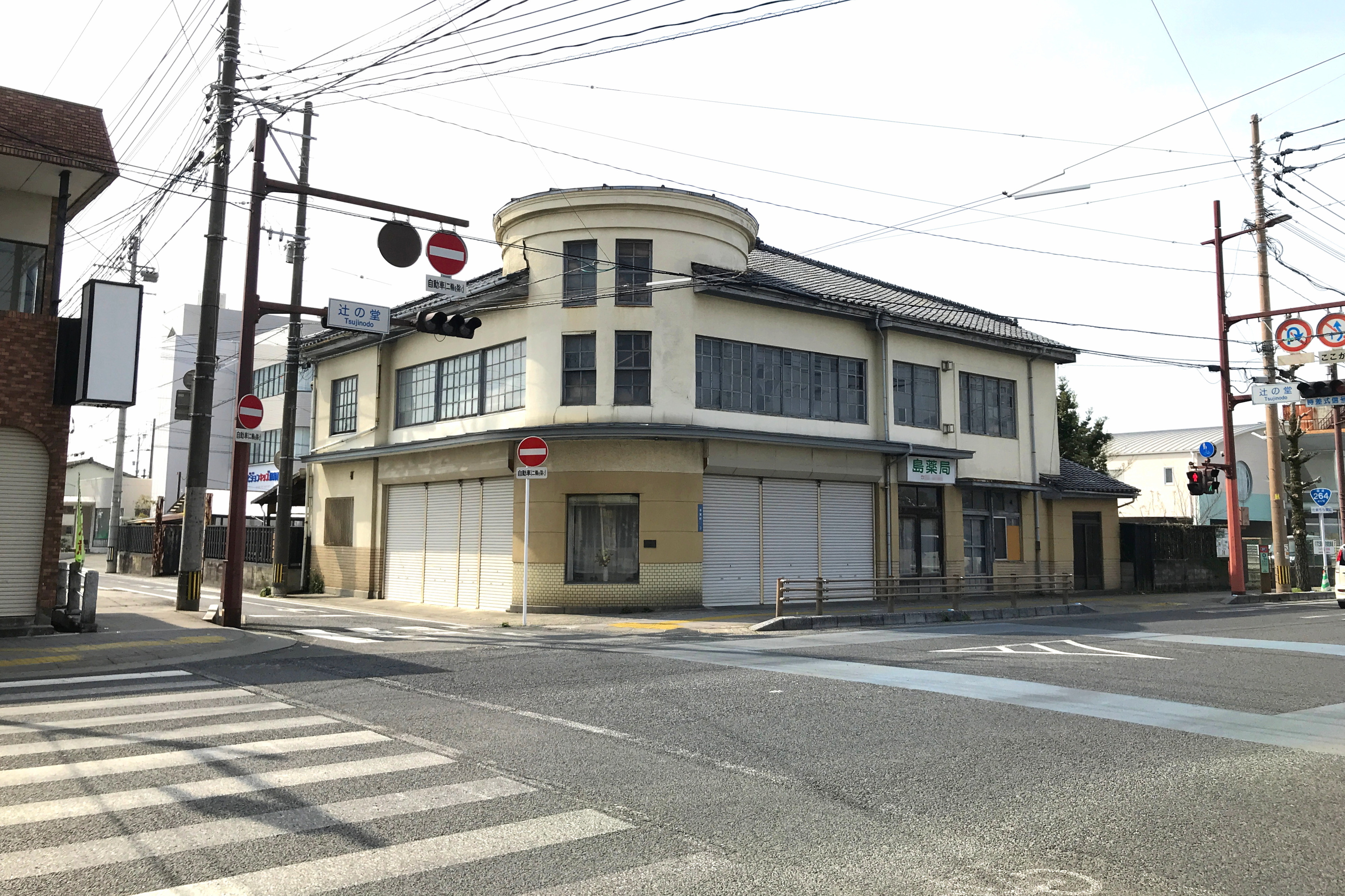
日本語: 佐賀市の辻の堂交差点。紡績通りと西いちょう通り(国道264号)が交わる。堀川町、川原町、与賀町の境。南西角の島薬局は1937年完成の和洋折衷の建物で、平成9年度(1997年)に佐賀市都市景観賞を受賞している[1]。
English: Tsujinodō Intersection of National Route No.264 in Saga, Saga. |
| Date | |
| Source | Own work |
| Author | Peka |
| Camera location | | View this and other nearby images on: OpenStreetMap |
|---|
Licensing
edit
I, the copyright holder of this work, hereby publish it under the following license:
This file is licensed under the Creative Commons Attribution-Share Alike 4.0 International license.
- You are free:
- to share – to copy, distribute and transmit the work
- to remix – to adapt the work
- Under the following conditions:
- attribution – You must give appropriate credit, provide a link to the license, and indicate if changes were made. You may do so in any reasonable manner, but not in any way that suggests the licensor endorses you or your use.
- share alike – If you remix, transform, or build upon the material, you must distribute your contributions under the same or compatible license as the original.
File history
Click on a date/time to view the file as it appeared at that time.
| Date/Time | Thumbnail | Dimensions | User | Comment | |
|---|---|---|---|---|---|
| current | 15:35, 12 June 2023 | | 3,990 × 2,660 (2.75 MB) | Peka (talk | contribs) | Uploaded own work with UploadWizard |
You cannot overwrite this file.
File usage on Commons
There are no pages that use this file.