File:Sainai River Bridge (Tazawako Line).jpg

Size of this preview: 800 × 450 pixels. Other resolutions: 320 × 180 pixels | 640 × 360 pixels | 1,024 × 576 pixels | 1,280 × 720 pixels | 2,560 × 1,440 pixels | 6,000 × 3,375 pixels.
Original file (6,000 × 3,375 pixels, file size: 7.71 MB, MIME type: image/jpeg)
Captions
Captions
Add a one-line explanation of what this file represents
Summary edit
.jpg&action=edit§ion=1)
| Description |
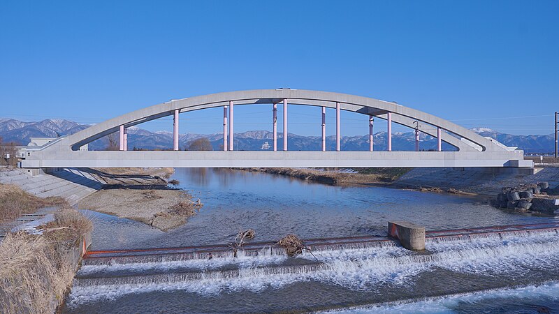
日本語: 田沢湖線・斉内川橋梁(秋田県大仙市)。現橋はランガー形式で2020年に竣工したもの。ガーター形式の旧橋梁を架け替えるため、その東側で建設工事が開始され、2020年11月14日から15日の一晩で旧橋の撤去、横取り工法による新橋の設置、線路の切替え工事までがなされた。 |
| Date | 24 February 2024, 15:32:48 |
| Source | Own work |
| Author | 掬茶 |
| Camera location | | View this and other nearby images on: OpenStreetMap |
|---|
.jpg¶ms=039.539168_N_0140.536024_E_globe:Earth_type:camera__&language=en)
Licensing edit
.jpg&action=edit§ion=2)
I, the copyright holder of this work, hereby publish it under the following license:
| This file is made available under the Creative Commons CC0 1.0 Universal Public Domain Dedication. | |
| The person who associated a work with this deed has dedicated the work to the public domain by waiving all of their rights to the work worldwide under copyright law, including all related and neighboring rights, to the extent allowed by law. You can copy, modify, distribute and perform the work, even for commercial purposes, all without asking permission.
|
File history
Click on a date/time to view the file as it appeared at that time.
| Date/Time | Thumbnail | Dimensions | User | Comment | |
|---|---|---|---|---|---|
| current | 14:19, 24 February 2024 | | 6,000 × 3,375 (7.71 MB) | 掬茶 (talk | contribs) | Uploaded own work with UploadWizard |
You cannot overwrite this file.
File usage on Commons
The following page uses this file:
File usage on other wikis
The following other wikis use this file:
- Usage on ja.wikipedia.org
.jpg&oldid=880239018)