File:Saint-Brevin-les-Pins (Loire-Atlantique) - Flickr - sybarite48.jpg
Size of this preview: 800 × 530 pixels. Other resolutions: 320 × 212 pixels | 640 × 424 pixels | 1,024 × 678 pixels | 1,280 × 848 pixels | 2,560 × 1,696 pixels | 4,928 × 3,264 pixels.
Original file (4,928 × 3,264 pixels, file size: 10.63 MB, MIME type: image/jpeg)
Captions
Captions
Add a one-line explanation of what this file represents
Summary
edit_-_Flickr_-_sybarite48.jpg&action=edit§ion=1)
| Description |
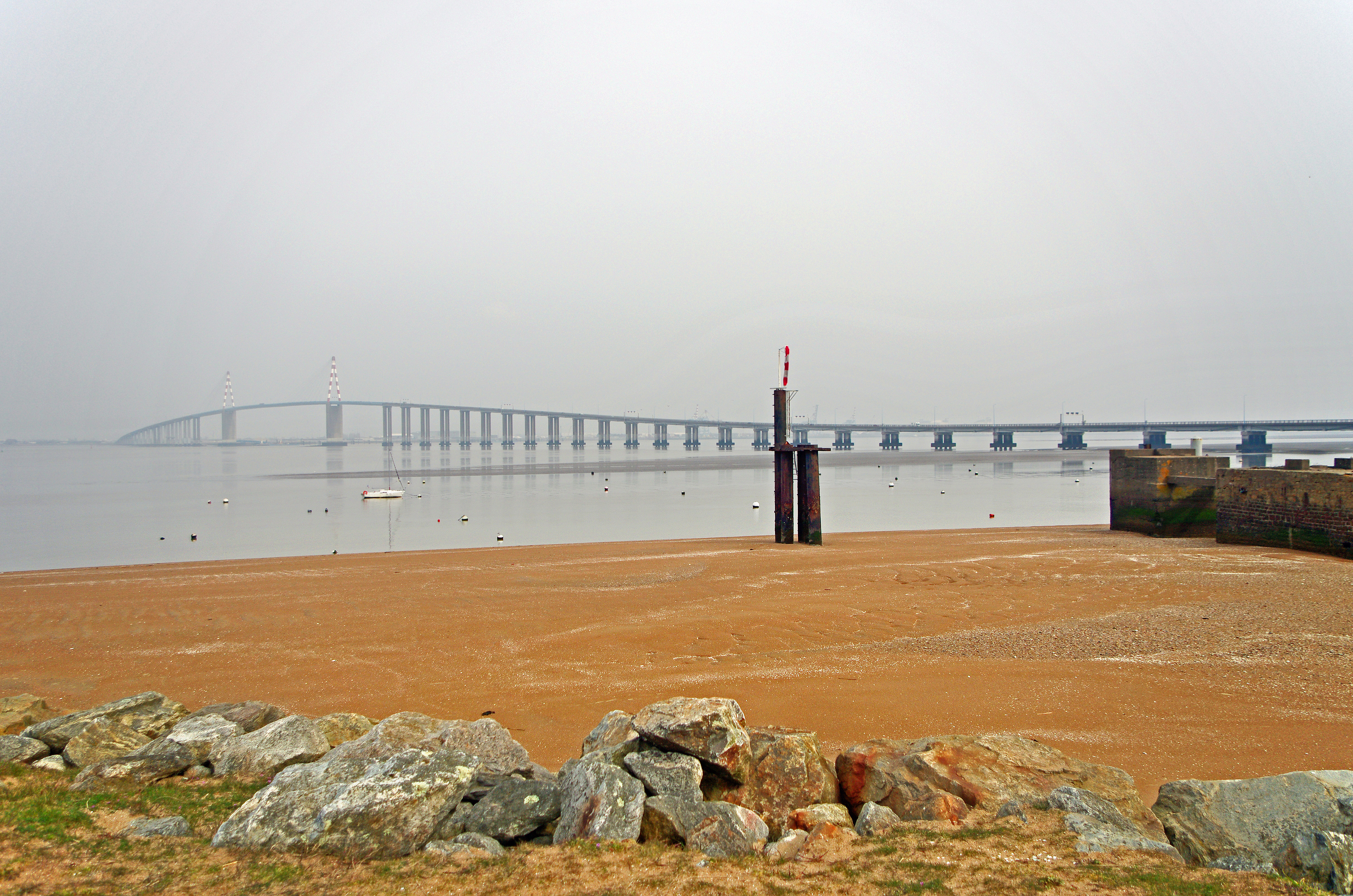
Saint-Brevin-les-Pins (Loire-Atlantique)
Le pont, supportant la Route bleue (D 213), est inauguré le 18 octobre 1975. Le pont à haubans avec les viaducs d'accès à une longueur totale de 3356 mètres. |
| Date | Taken on 24 March 2016, 11:14 |
| Source | Saint-Brevin-les-Pins (Loire-Atlantique) |
| Author | Daniel Jolivet |
| Flickr tags | loire-atlantique, france, saint-brevin-les-pins, la loire, pont suspendu, suspension bridge, suspended bridge, hängebrücke, aufhebungbrücke, جسر معلق, 式悬索桥, 悬索桥, 悬桥, puente colgante, puente de suspensión, κρεμαστή γέφυρα της, κρεμαστής γέφυρας, κρεμαστή γέφυρα που, ponte sospeso, ponte di sospensione, つり橋, 吊り橋, のつり橋, wiszący most, zawieszenie most, ponte pênsil, ponte de suspensão, ponte suspensa, висячий мост, висячим мостом, подвесной мост, hangbrug, asma köprüsü, viaduc, viaduct, viadukt, جسر, قنطرة متعددة ركائز, 高架桥, viaducto, οδογέφυρα, 高架橋, wiadukt, viaduto, виадук, viyadük, fleuve, fluss, river, نهر, 河, río, ποτάμι, fiume, 川, rivier, rzeka, rio, река, nehir, saint-brévin-les-pins |
| Camera location | | View this and other nearby images on: OpenStreetMap |
|---|
_-_Flickr_-_sybarite48.jpg¶ms=047.268833_N_-002.167606_E_globe:Earth_type:camera_source:Flickr_&language=en)
Licensing
edit_-_Flickr_-_sybarite48.jpg&action=edit§ion=2)
This file is licensed under the Creative Commons Attribution 2.0 Generic license.
- You are free:
- to share – to copy, distribute and transmit the work
- to remix – to adapt the work
- Under the following conditions:
- attribution – You must give appropriate credit, provide a link to the license, and indicate if changes were made. You may do so in any reasonable manner, but not in any way that suggests the licensor endorses you or your use.
| This image was originally posted to Flickr by sybarite48 at https://flickr.com/photos/26082117@N07/30953863698. It was reviewed on 17 August 2020 by FlickreviewR 2 and was confirmed to be licensed under the terms of the cc-by-2.0. |
File history
Click on a date/time to view the file as it appeared at that time.
| Date/Time | Thumbnail | Dimensions | User | Comment | |
|---|---|---|---|---|---|
| current | 01:16, 17 August 2020 | | 4,928 × 3,264 (10.63 MB) | Red panda bot (talk | contribs) | In Flickr Explore: 2018-09-21 |
You cannot overwrite this file.
File usage on Commons
There are no pages that use this file.
_-_Flickr_-_sybarite48.jpg&oldid=887789335)