File:Saint-Brieuc - Rue Saint-Pierre - AD22 - 16FI4984.jpg

Size of this preview: 370 × 599 pixels. Other resolutions: 148 × 240 pixels | 296 × 480 pixels | 998 × 1,616 pixels.
Original file (998 × 1,616 pixels, file size: 394 KB, MIME type: image/jpeg)
Captions
Captions
Add a one-line explanation of what this file represents
Summary
edit
| Français : Carte postale des Côtes-d'Armor
( |
||||||||||||||
|---|---|---|---|---|---|---|---|---|---|---|---|---|---|---|
| Photographer |
à préciser |
|||||||||||||
| Title |
Français : Carte postale des Côtes-d'Armor |
|||||||||||||
| Description |
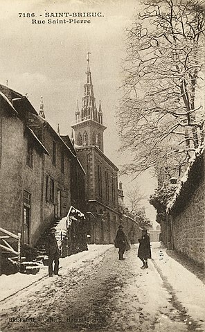
Rue Saint-Pierre. |
|||||||||||||
| Depicted place | Saint-Brieuc | |||||||||||||
| Date | sans date [1917-1925] | |||||||||||||
| Medium | Carte postale | |||||||||||||
| Dimensions | 14 X 9 | |||||||||||||
| Collection |
|
|||||||||||||
| Accession number |
AD22 - 16FI4984 |
|||||||||||||
| Source | https://datarmor.cotesdarmor.fr/data-presentation-ux/#/cg22/datasets/archives_numerisation_carte_postale/views/desc?hideControlPanel=true | |||||||||||||
| Object location | | View this and other nearby images on: OpenStreetMap |
|---|
Licensing
edit
| This file is licensed under the Licence Ouverte 1.0 (License text, English license text).
|
File history
Click on a date/time to view the file as it appeared at that time.
| Date/Time | Thumbnail | Dimensions | User | Comment | |
|---|---|---|---|---|---|
| current | 08:41, 12 January 2021 | | 998 × 1,616 (394 KB) | Daieuxetdailleurs (talk | contribs) | pattypan 20.04 |
You cannot overwrite this file.
File usage on Commons
The following 2 pages use this file: