File:Sakitatenami kohungun aerial 2.jpg
Size of this preview: 372 × 599 pixels. Other resolutions: 149 × 240 pixels | 298 × 480 pixels | 952 × 1,532 pixels.
Original file (952 × 1,532 pixels, file size: 1.93 MB, MIME type: image/jpeg)
Captions
Captions
Add a one-line explanation of what this file represents
Summary edit
| Description | |
| Date | |
| Source |
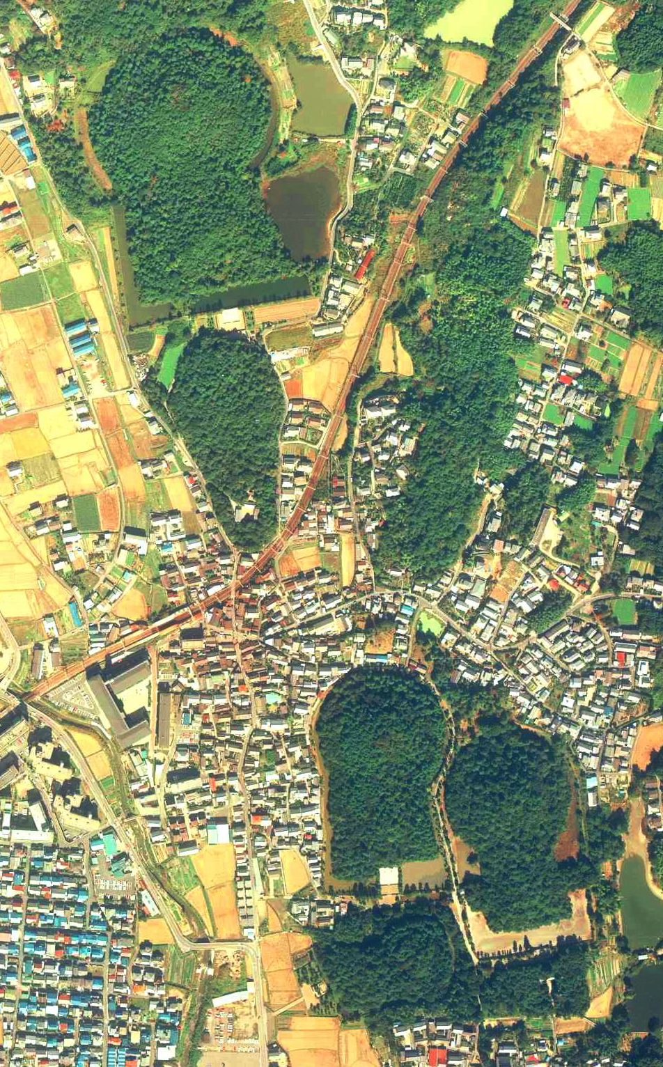
国土画像情報(カラー空中写真)国土交通省撮影の空中写真CKK853-C10-6を使用。
|
| Author | 国土交通省国土地理院 |
| Camera location | | View this and other nearby images on: OpenStreetMap |
|---|
Licensing edit

|
The copyright holder of this file, the Ministry of Land, Infrastructure, Transport and Tourism of Japan, allows anyone to use it for any purpose, provided that the copyright holder is properly attributed. Redistribution, derivative work, commercial use, and all other use is permitted. |
Attribution:
Copyright © National Land Image Information (Color Aerial Photographs), Ministry of Land, Infrastructure, Transport and Tourism
|
 |
This image is copyrighted by the Ministry of Land, Infrastructure, Transport and Tourism of Japan. For terms of use, see the stipulation to use of National Land Information (in Japanese) and message from MLIT (in Japanese and English). When you display this image on an article, include the following phrase in the description: "Made based on National Land Image Information (Color Aerial Photographs), Ministry of Land, Infrastructure, Transport and Tourism".
|
File history
Click on a date/time to view the file as it appeared at that time.
| Date/Time | Thumbnail | Dimensions | User | Comment | |
|---|---|---|---|---|---|
| current | 15:32, 30 October 2021 | | 952 × 1,532 (1.93 MB) | 名古屋太郎 (talk | contribs) | 明るさ等変更 |
| 23:36, 27 December 2009 |  | 560 × 900 (105 KB) | Weatherman2009 (talk | contribs) | {{Information |Description=佐紀盾列古墳群:奈良県奈良市山陵町宮ノ谷:五社神古墳(伝神功皇后狭城楯列池上陵)(左上)・佐紀石塚山古墳(伝成務天皇狭城盾列池後陵)� |
You cannot overwrite this file.
File usage on Commons
There are no pages that use this file.
File usage on other wikis
The following other wikis use this file:
- Usage on en.wikipedia.org
- Usage on ja.wikipedia.org
- Usage on zh.wikipedia.org