File:Salt Lake City panoramic map.jpg

Size of this preview: 800 × 431 pixels. Other resolutions: 320 × 172 pixels | 640 × 345 pixels | 1,024 × 551 pixels | 1,280 × 689 pixels | 2,560 × 1,378 pixels | 21,314 × 11,473 pixels.
Original file (21,314 × 11,473 pixels, file size: 39.22 MB, MIME type: image/jpeg)
Captions
Captions
Add a one-line explanation of what this file represents
| Warning | The original file is very high-resolution. It might not load properly or could cause your browser to freeze when opened at full size. |
|---|
Summary
edit
| Description |
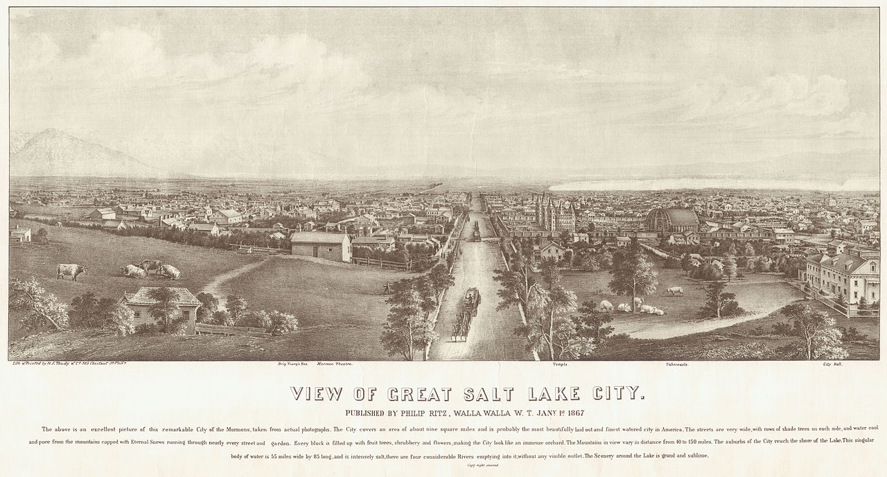
English: Panoramic map of Salt Lake City published in 1867. Shows the Salt Lake Temple and the Salt Lake Tabernacle under construction. Português: Mapa panorámico de Salt Lake City, publicado em 1867. Mostra-se o Templo de Salt Lake e o Tabernáculo de Salt Lake, que estavam sendo construidos. |
| Date | |
| Source | Brigham Young University Harold B. Lee Library Maps Collection |
| Author | H.J. Toudy |
Licensing
edit
This media file is in the public domain in the United States. This applies to U.S. works where the copyright has expired, often because its first publication occurred prior to January 1, 1929, and if not then due to lack of notice or renewal. See this page for further explanation.
|
 | |
 |
This image might not be in the public domain outside of the United States; this especially applies in the countries and areas that do not apply the rule of the shorter term for US works, such as Canada, Mainland China (not Hong Kong or Macao), Germany, Mexico, and Switzerland. The creator and year of publication are essential information and must be provided. See Wikipedia:Public domain and Wikipedia:Copyrights for more details.
|
File history
Click on a date/time to view the file as it appeared at that time.
| Date/Time | Thumbnail | Dimensions | User | Comment | |
|---|---|---|---|---|---|
| current | 00:35, 1 December 2012 | | 21,314 × 11,473 (39.22 MB) | Tsmith ut (talk | contribs) | User created page with UploadWizard |
You cannot overwrite this file.
File usage on Commons
There are no pages that use this file.
File usage on other wikis
The following other wikis use this file:
- Usage on en.wikipedia.org