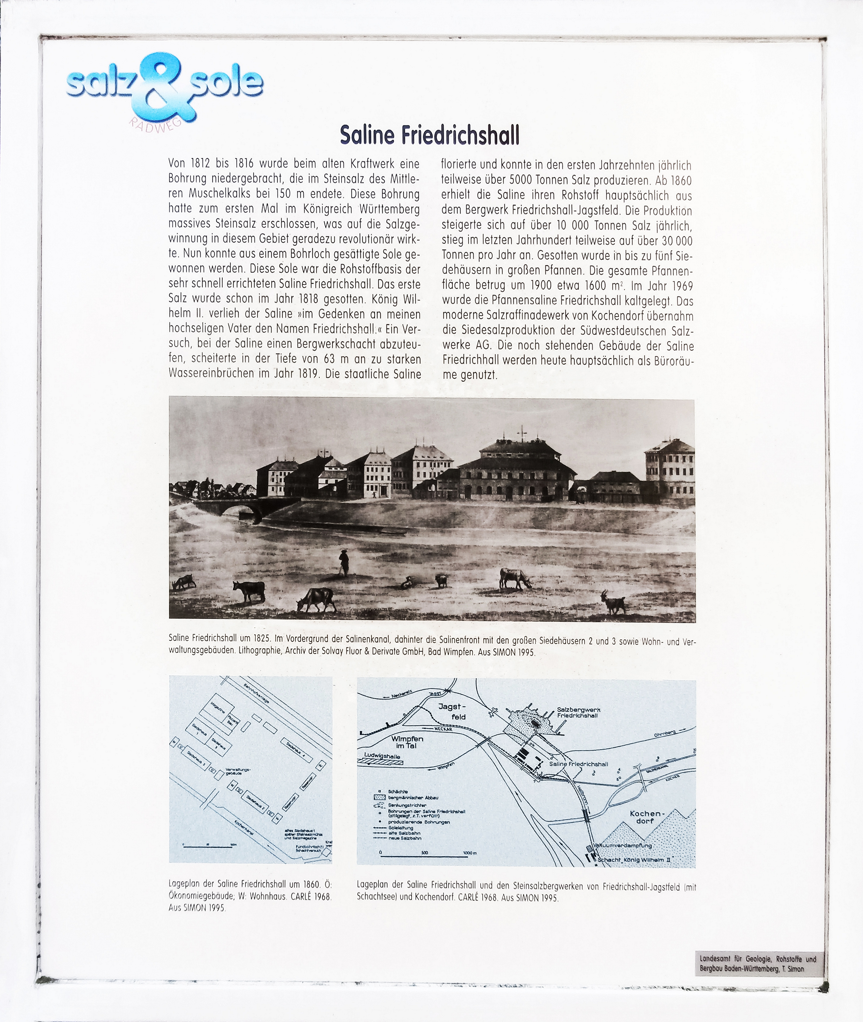
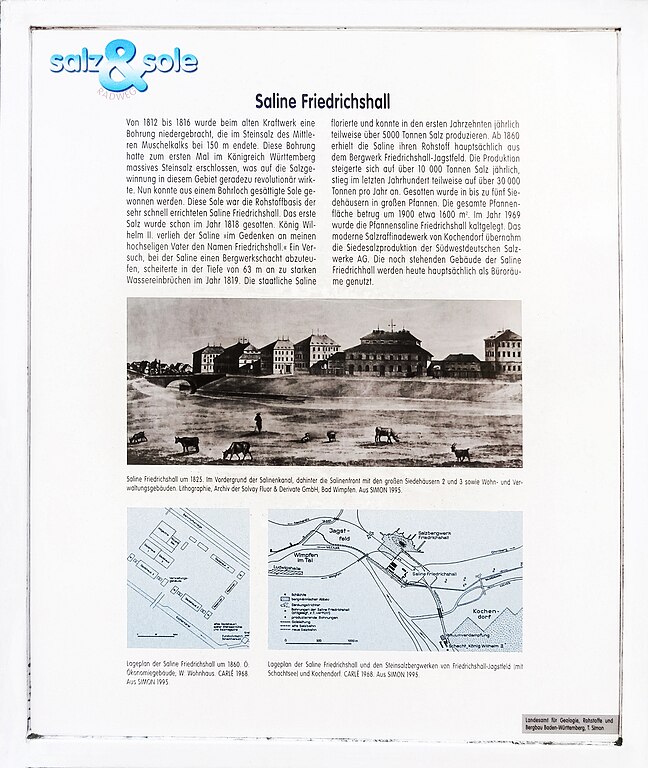
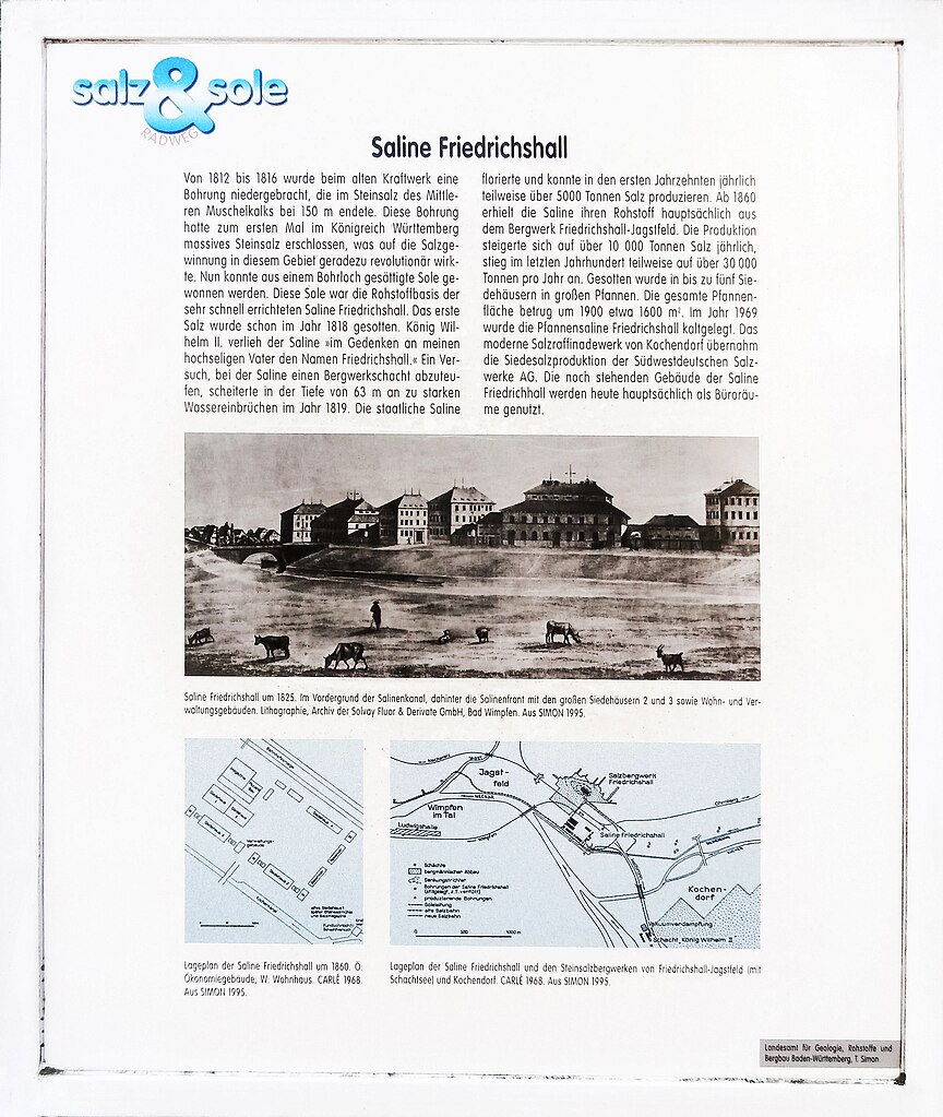
File:Salz&Sole-Radweg Friedrichshall.jpg
Size of this preview: 506 × 599 pixels. Other resolutions: 203 × 240 pixels | 405 × 480 pixels | 648 × 768 pixels | 864 × 1,024 pixels | 1,729 × 2,048 pixels | 2,836 × 3,359 pixels.
Original file (2,836 × 3,359 pixels, file size: 3.03 MB, MIME type: image/jpeg)
Captions
Captions
Add a one-line explanation of what this file represents
Summary
edit| Description | |
| Date | |
| Source | Own work |
| Author | Sarang |
| Other versions |
|


| Object location | | View this and other nearby images on: OpenStreetMap |
|---|
Licensing
edit
| I, the copyright holder of this work, release this work into the public domain. This applies worldwide. In some countries this may not be legally possible; if so: I grant anyone the right to use this work for any purpose, without any conditions, unless such conditions are required by law. |
File history
Click on a date/time to view the file as it appeared at that time.
| Date/Time | Thumbnail | Dimensions | User | Comment | |
|---|---|---|---|---|---|
| current | 08:47, 4 May 2021 | | 2,836 × 3,359 (3.03 MB) | Sarang (talk | contribs) | Reduktion auf die Infotafel, ohne die Natur der Umgebung |
| 16:54, 3 May 2021 |  | 3,004 × 4,369 (3.43 MB) | Georgfotoart (talk | contribs) | Bildfehler (P4257499.JPG) | |
| 07:43, 25 April 2021 |  | 2,857 × 3,644 (3 MB) | Sarang (talk | contribs) | {{Information |Description={{de|Infotafel des "salz&sole radweg" im Salinengebiet in Bad Friedrichshall (Jagstfeld).}} |Date=2021-04-25 |Source={{Own}} |Author={{U|Sarang}} |Other versions={{G|Salzwanderweg 7.jpg|Salinengelände Jagstfeld BFH Info.jpg|f=2}} }} == {{int:license-header}} == {{PD-self}} Sal |
You cannot overwrite this file.
File usage on Commons
The following page uses this file:
- File:Salz&Sole-Radweg Saline.jpg (file redirect)