File:Samoa geologic map.png
Size of this preview: 800 × 351 pixels. Other resolutions: 320 × 140 pixels | 640 × 281 pixels | 1,350 × 592 pixels.
Original file (1,350 × 592 pixels, file size: 171 KB, MIME type: image/png)
Captions
Captions
Add a one-line explanation of what this file represents
Summary
edit
| Description |
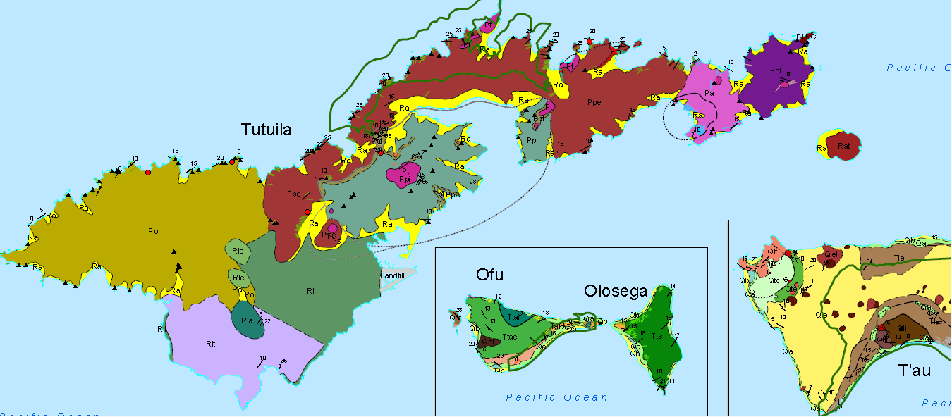
English: Samoa geologic map, where Volcanic Series are labeled as: Po for Taputapu, Rll and Rlt for Leone (Rla is an ash cone and Rlc is a cinder cone), Pa for Alofau, Pol for Olomoana, Ppe for Pago, and Ppi for Pago Intra-Caldera. Pt are trachyte plugs and dikes, such as Matafao, Vatia, and Pioa ("the rainmaker"). Ra depicts beach sand and alluvium, while the green line is the national park boundary, and the dashed line is the boundary of the caldera. |
| Date | |
| Source | National Park of American Samoa, Geologic Resource Evaluation Report, Natural Resource Report NPS/NRPC/GRD/NRR - 2008/25 |
| Author | National Park Service, US Dept. of the Interior |
Licensing
edit
| This image or media file contains material based on a work of a National Park Service employee, created as part of that person's official duties. As a work of the U.S. federal government, such work is in the public domain in the United States. See the NPS website and NPS copyright policy for more information. |
File history
Click on a date/time to view the file as it appeared at that time.
| Date/Time | Thumbnail | Dimensions | User | Comment | |
|---|---|---|---|---|---|
| current | 13:43, 26 April 2017 | | 1,350 × 592 (171 KB) | Pi3.124 (talk | contribs) | User created page with UploadWizard |
You cannot overwrite this file.
File usage on Commons
There are no pages that use this file.
File usage on other wikis
The following other wikis use this file:
- Usage on en.wikipedia.org
- Usage on he.wikipedia.org