File:Samoa location map2.svg

Size of this PNG preview of this SVG file: 800 × 411 pixels. Other resolutions: 320 × 165 pixels | 640 × 329 pixels | 1,024 × 527 pixels | 1,280 × 658 pixels | 2,560 × 1,317 pixels | 2,057 × 1,058 pixels.
Original file (SVG file, nominally 2,057 × 1,058 pixels, file size: 22 KB)
Captions
Captions
Add a one-line explanation of what this file represents
Summary edit
| Description |
Français : Carte de géolocalisation, projection équirectangulaire. Limites géographiques de la carte :
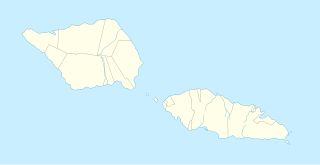
English: Location map of Samoa, equirectangular projection. Geographic limits of the map:
|
| Date | |
| Source | adaptation de file:Samoa_Country_map.png et file:Samoa mk.svg |
| Author | Ahnode + Xfigpower |
| Other versions |
|

Licensing edit
This file is licensed under the Creative Commons Attribution-Share Alike 4.0 International license.
- You are free:
- to share – to copy, distribute and transmit the work
- to remix – to adapt the work
- Under the following conditions:
- attribution – You must give appropriate credit, provide a link to the license, and indicate if changes were made. You may do so in any reasonable manner, but not in any way that suggests the licensor endorses you or your use.
- share alike – If you remix, transform, or build upon the material, you must distribute your contributions under the same or compatible license as the original.
File history
Click on a date/time to view the file as it appeared at that time.
| Date/Time | Thumbnail | Dimensions | User | Comment | |
|---|---|---|---|---|---|
| current | 14:09, 3 December 2021 | | 2,057 × 1,058 (22 KB) | Xfigpower (talk | contribs) | Uploaded a work by {{u|Ahnode}}+{{u|Xfigpower}} from adaptation de file:Samoa_Country_map.png+file:Samoa mk.svg with UploadWizard |
You cannot overwrite this file.
File usage on Commons
The following page uses this file:
File usage on other wikis
The following other wikis use this file:
- Usage on de.wikipedia.org
- Apia
- Upolu
- Savaiʻi
- National Soccer Stadium (Samoa)
- Manono
- Apolima
- Aleipata-Inseln
- Flughafen Faleolo
- Vorlage:Positionskarte Samoa
- Silisili
- Toleafoa J. S. Blatter Soccer Stadium
- Matavanu
- Apia Park
- Papaseʻea
- Solosolo (Upolu)
- Vailoa (Savai'i)
- Gagaifo o le Vao
- Savaia
- Tafagamanu
- Safaʻatoa
- Faleaseela
- Matafaʻa
- Matanofo
- Samaʻi
- Falevai (Upolu)
- Matanofo (Falevai)
- Ulutogia
- Gataivai
- Nuʻusafeʻe
- Uafato
- Nuʻulopa
- Neiafu (Savaiʻi)
- Lufilufi
- Piula Cave Pool
- Satapuala
- Vavau (Samoa)
- Benutzer:Shi Annan/Falefa
- Matatufu
- Leatupe
- Sapoʻe
- Lotofaga
- Utulaelae
- Faleapuna
- Saoluafata
- Lalomanu
- Alafua
- Nuʻutele
- Nuʻulua
- Fanuatapu (Samoa)
- Namua
View more global usage of this file.