File:SanFerValleyLowerVN.gif
No higher resolution available.
SanFerValleyLowerVN.gif (690 × 438 pixels, file size: 344 KB, MIME type: image/gif)
Captions
Captions
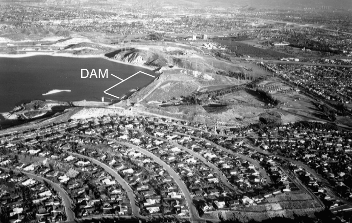
Lower Van Norman Dam above the San Fernando Valley
Summary
edit
| Description |
English: This is a large reservoir, perched just above the densely populated San Fernando Valley. |
| Date | Unknown date |
| Source | https://pubs.usgs.gov/fs/1995/0096/ |
| Author | US Geological Survey |
| Camera location | | View this and other nearby images on: OpenStreetMap |
|---|
Licensing
edit
This image is in the public domain in the United States because it only contains materials that originally came from the United States Geological Survey, an agency of the United States Department of the Interior. For more information, see the official USGS copyright policy.
|
File history
Click on a date/time to view the file as it appeared at that time.
| Date/Time | Thumbnail | Dimensions | User | Comment | |
|---|---|---|---|---|---|
| current | 00:36, 23 July 2021 | | 690 × 438 (344 KB) | Rsjaffe (talk | contribs) | Uploaded a work by US Geological Survey from https://pubs.usgs.gov/fs/1995/0096/ with UploadWizard |
You cannot overwrite this file.
File usage on Commons
The following page uses this file: