File:Sanborn Fire Insurance Map from Navarre, Stark County, Ohio, 1911, Plate 0001.jpg
Size of this preview: 506 × 599 pixels. Other resolutions: 203 × 240 pixels | 405 × 480 pixels | 649 × 768 pixels | 865 × 1,024 pixels | 1,730 × 2,048 pixels | 6,510 × 7,707 pixels.
Original file (6,510 × 7,707 pixels, file size: 3.16 MB, MIME type: image/jpeg)
Captions
Captions
Add a one-line explanation of what this file represents
Summary
edit
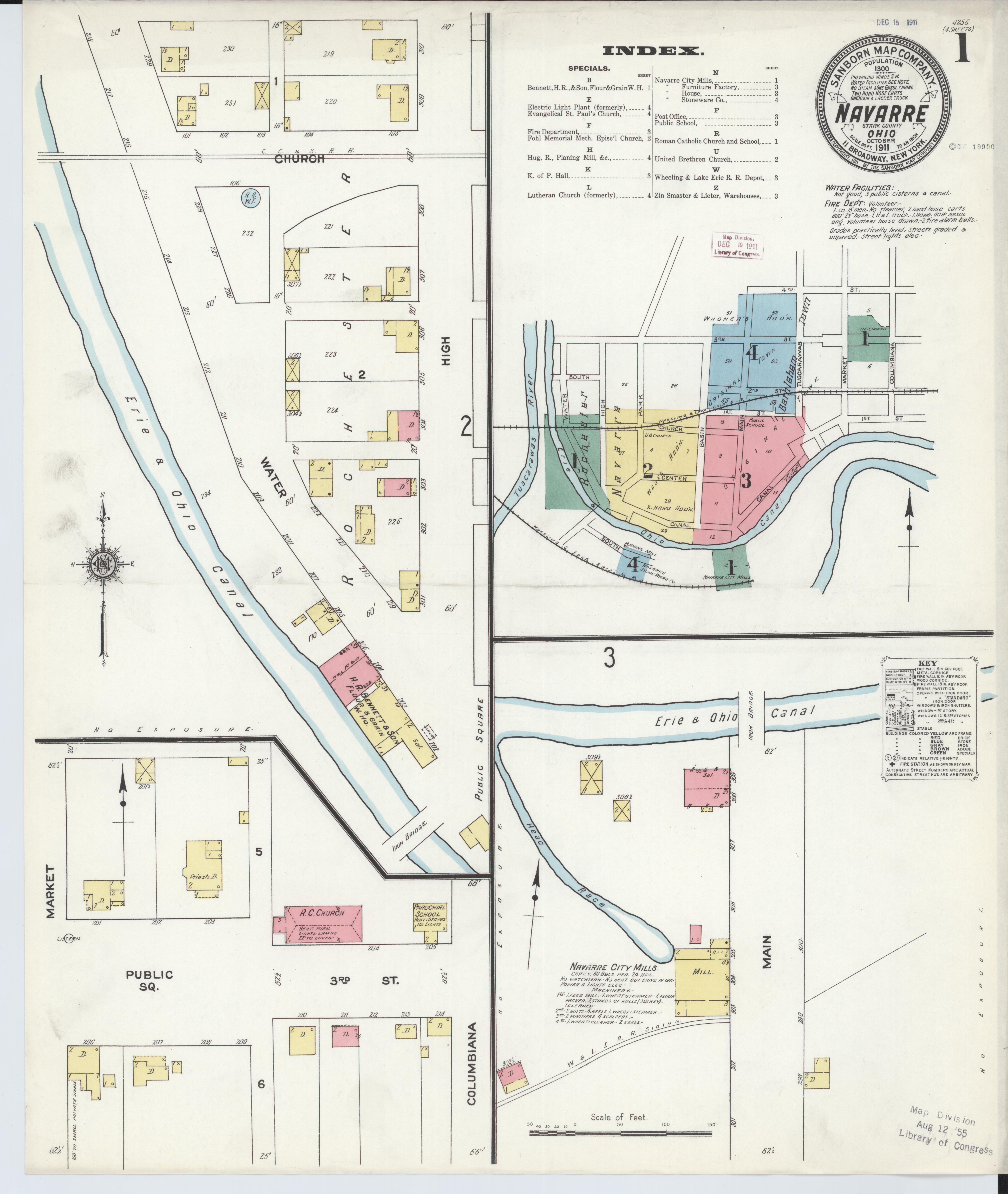
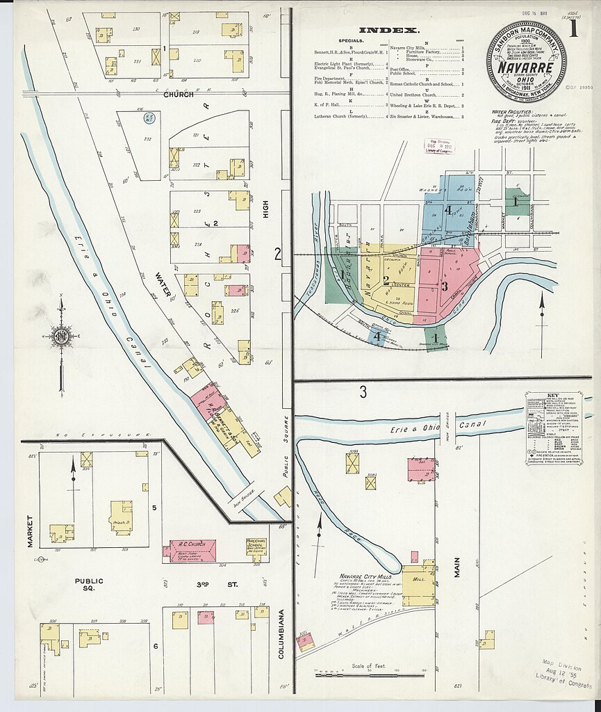
| Description | Sanborn Fire Insurance Map from Navarre, Stark County, Ohio, 1911, Plate 0001 |
| Date | |
| Source | https://tile.loc.gov/image-services/iiif/service:gmd:gmd408m:g4084m:g4084nm:g4084nm_g068171911:06817_1911-0001/full/pct:100/0/default.jpg |
| Author | Unknown author |
Licensing
edit
This work is in the public domain in the United States because it was published (or registered with the U.S. Copyright Office) before January 1, 1929.
Public domain works must be out of copyright in both the United States and in the source country of the work in order to be hosted on the Commons. If the work is not a U.S. work, the file must have an additional copyright tag indicating the copyright status in the source country.
Note: This tag should not be used for sound recordings. |
File history
Click on a date/time to view the file as it appeared at that time.
| Date/Time | Thumbnail | Dimensions | User | Comment | |
|---|---|---|---|---|---|
| current | 19:04, 29 December 2023 | | 6,510 × 7,707 (3.16 MB) | Nowakki (talk | contribs) | == {{int:filedesc}} == {{Information |description=Sanborn Fire Insurance Map from Navarre, Stark County, Ohio, 1911, Plate 0001 |date=1911 |source=https://tile.loc.gov/image-services/iiif/service:gmd:gmd408m:g4084m:g4084nm:g4084nm_g068171911:06817_1911-0001/full/pct:100/0/default.jpg |author={{Unknown|1=Author}} }} == {{int:license-header}} == {{PD-US-expired}} Category:Sanborn Fire Insurance Map from Navarre, Stark County, Ohio, 1911 |
You cannot overwrite this file.
File usage on Commons
There are no pages that use this file.