File:Sandy 2012 snowfall.gif

Size of this preview: 649 × 600 pixels. Other resolutions: 260 × 240 pixels | 520 × 480 pixels | 1,010 × 933 pixels.
Original file (1,010 × 933 pixels, file size: 30 KB, MIME type: image/gif)
Captions
Captions
Add a one-line explanation of what this file represents
Summary
| Description |
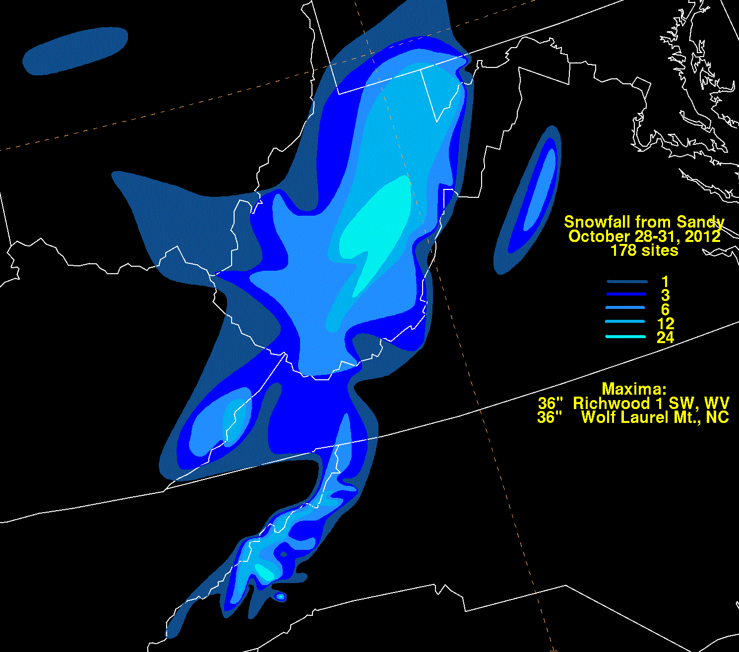
English: Storm total snowfall map of Hurricane Sandy during October 2012. |
|||
| Date | ||||
| Source | WPC tropical cyclone rainfall data | |||
| Author | David Roth, Weather Prediction Center, Camp Springs, Maryland | |||
| Permission (Reusing this file) |
|
File history
Click on a date/time to view the file as it appeared at that time.
| Date/Time | Thumbnail | Dimensions | User | Comment | |
|---|---|---|---|---|---|
| current | 18:50, 15 November 2012 | | 1,010 × 933 (30 KB) | Thegreatdr (talk | contribs) | User created page with UploadWizard |
You cannot overwrite this file.
File usage on Commons
The following page uses this file:
- File:Sandy2012filledsnowblk.gif (file redirect)
File usage on other wikis
The following other wikis use this file:
- Usage on en.wikipedia.org
- Usage on fr.wikipedia.org
- Usage on it.wikipedia.org