File:Sankt Margarethen Unterfeuer.jpg

Size of this preview: 450 × 600 pixels. Other resolutions: 180 × 240 pixels | 360 × 480 pixels | 576 × 768 pixels | 768 × 1,024 pixels | 1,536 × 2,048 pixels | 3,941 × 5,254 pixels.
Original file (3,941 × 5,254 pixels, file size: 8.5 MB, MIME type: image/jpeg)
Captions
Captions
Add a one-line explanation of what this file represents
Summary
edit
| Description |
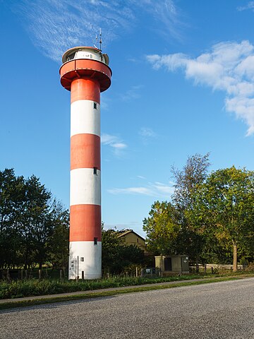
Deutsch: Unterfeuer Scheelenkuhlen an der B 431, neben Heideducht 25 südöstlich von St. Margarethen |
| Date | |
| Source | Self-photographed |
| Author | Radler59 (talk) |
| Openstreetmap entry | Link to Openstreetmap |
| Object location | | View this and other nearby images on: OpenStreetMap |
|---|
| Camera location | | View this and other nearby images on: OpenStreetMap |
|---|
Licensing
edit
This file is licensed under the Creative Commons Attribution-Share Alike 4.0 International license.
- You are free:
- to share – to copy, distribute and transmit the work
- to remix – to adapt the work
- Under the following conditions:
- attribution – You must give appropriate credit, provide a link to the license, and indicate if changes were made. You may do so in any reasonable manner, but not in any way that suggests the licensor endorses you or your use.
- share alike – If you remix, transform, or build upon the material, you must distribute your contributions under the same or compatible license as the original.
File history
Click on a date/time to view the file as it appeared at that time.
| Date/Time | Thumbnail | Dimensions | User | Comment | |
|---|---|---|---|---|---|
| current | 13:13, 6 September 2020 | | 3,941 × 5,254 (8.5 MB) | Radler59 (talk | contribs) | Uploaded with LrMediaWiki 0.8.0, LR 5.7.1 Win |
You cannot overwrite this file.
File usage on Commons
The following 2 pages use this file: