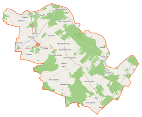
File:Sarnaki (gmina) location map.png

Size of this preview: 729 × 599 pixels. Other resolutions: 292 × 240 pixels | 584 × 480 pixels | 934 × 768 pixels | 1,107 × 910 pixels.
Original file (1,107 × 910 pixels, file size: 261 KB, MIME type: image/png)
Captions
Captions
Add a one-line explanation of what this file represents
| Description |
Polski: Mapa gminy Sarnaki, Polska
English: Map of Gmina Sarnaki, Poland |
|||||||||
| Date | ||||||||||
| Source | You may find a page on the OpenStreetMap wiki page for Sarnaki (gmina) | |||||||||
| Creator |
OpenStreetMap contributors OpenStreetMap contributors |
|||||||||
| Permission (Reusing this file) |
OpenStreetMap data is available under the Open Database License (details). Map tiles are licensed under the Creative Commons Attribution-ShareAlike 2.0 license (CC-BY-SA 2.0).
This file is licensed under the Creative Commons Attribution-Share Alike 2.0 Generic license.
|
|||||||||
| Geotemporal data | ||||||||||
| Bounding box |
|
|||||||||
| Georeferencing | If inappropriate please set warp_status = skip to hide. | |||||||||
File history
Click on a date/time to view the file as it appeared at that time.
| Date/Time | Thumbnail | Dimensions | User | Comment | |
|---|---|---|---|---|---|
| current | 11:13, 12 September 2014 | | 1,107 × 910 (261 KB) | VanWiel (talk | contribs) | |
| 07:10, 1 August 2014 |  | 1,107 × 910 (250 KB) | VanWiel (talk | contribs) | {{OpenStreetMap | name = Sarnaki (gmina) | location = Sarnaki (gmina) | description = {{pl|Mapa gminy Sarnaki, Polska}} {{en|Map of Gmina Sarnaki, Poland}} | top = 52.3798 | left = 22.7994 | right... |
You cannot overwrite this file.
File usage on Commons
There are no pages that use this file.
File usage on other wikis
The following other wikis use this file:
- Usage on fr.wikipedia.org
- Usage on nl.wikipedia.org
- Usage on pl.wikipedia.org
- Sarnaki
- Sarnaki (gmina)
- Bonin-Ogródki
- Borsuki (województwo mazowieckie)
- Bużka
- Chlebczyn
- Chybów
- Hołowczyce-Kolonia
- Horoszki Duże
- Horoszki Małe
- Klepaczew
- Klimczyce
- Klimczyce-Kolonia
- Mierzwice-Kolonia
- Nowe Hołowczyce
- Nowe Litewniki
- Nowe Mierzwice
- Płosków-Kolonia
- Rzewuszki
- Serpelice
- Stare Litewniki
- Stare Mierzwice
- Terlików
- Zabuże (województwo mazowieckie)
- Bonin (województwo mazowieckie)
- Franopol (województwo mazowieckie)
- Płosków (województwo mazowieckie)
- Raczki (województwo mazowieckie)
- Rozwadów (województwo mazowieckie)
- Binduga (powiat łosicki)
- Grzybów (powiat łosicki)
- Kózki (powiat łosicki)
- Stare Hołowczyce
- Sarnaki (przystanek kolejowy)
- Fronołów (przystanek kolejowy)
- Rezerwat przyrody Kózki
- Rezerwat przyrody Zabuże
- Cmentarz żydowski w Sarnakach
- Parafia św. Stanisława Biskupa i Męczennika w Sarnakach
- Parafia św. Apostołów Piotra i Pawła w Serpelicach
- Rezerwat przyrody Mierzwice
- Sarenka
- Sułów-Gajówka
- Wisielec-Gajówka
- Kościół św. Stanisława w Sarnakach (stary)
- Kościół Matki Bożej Anielskiej w Horoszkach Dużych
- Cmentarz przykościelny w Sarnakach
- Moduł:Mapa/dane/Sarnaki (gmina)
View more global usage of this file.
_location_map.png)
_location_map.png&oldid=499492638)