File:Satellite Image of Lake Heihai.png

Size of this preview: 800 × 500 pixels. Other resolutions: 320 × 200 pixels | 640 × 400 pixels | 1,024 × 639 pixels | 1,278 × 798 pixels.
Original file (1,278 × 798 pixels, file size: 1.62 MB, MIME type: image/png)
Captions
Captions
Add a one-line explanation of what this file represents
Summary
edit
| Description |
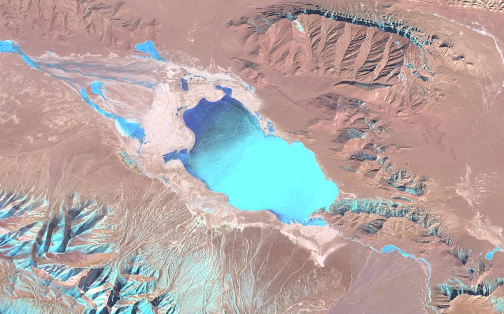
English: Satellite Image of Lake Heihai, Qinghai, China
中文:黑海 (青海省) 卫星图像 |
| Source | NASA Landsat Image |
| Author | NASA |
| Camera location | | View this and other nearby images on: OpenStreetMap |
|---|
Licensing
edit
| This file is in the public domain in the United States because it was solely created by NASA. NASA copyright policy states that "NASA material is not protected by copyright unless noted". (See Template:PD-USGov, NASA copyright policy page or JPL Image Use Policy.) | ||
 |
Warnings:
|
File history
Click on a date/time to view the file as it appeared at that time.
| Date/Time | Thumbnail | Dimensions | User | Comment | |
|---|---|---|---|---|---|
| current | 14:04, 14 March 2009 | | 1,278 × 798 (1.62 MB) | Camphora (talk | contribs) | {{Information |Description={{en|1=Satellite Image of Lake Heihai, Qinghai, China}} {{zh|1=黑海 (青海省) 卫星图像}} |Source=NASA Landsat Image |Author=NASA |Date= |Permission= |other_versions= }} {{Location|36|00|00|N|93|15|00|E|region:CN_scale:10 |
You cannot overwrite this file.
File usage on Commons
The following page uses this file:
File usage on other wikis
The following other wikis use this file:
- Usage on en.wikipedia.org
- Usage on pa.wikipedia.org
- Usage on ru.wikipedia.org
- Usage on zh.wikipedia.org