File:Satellite image of the Grand Canyon.jpeg
Original file (1,219 × 947 pixels, file size: 299 KB, MIME type: image/jpeg)
Captions
Captions
Summary edit
| Description |
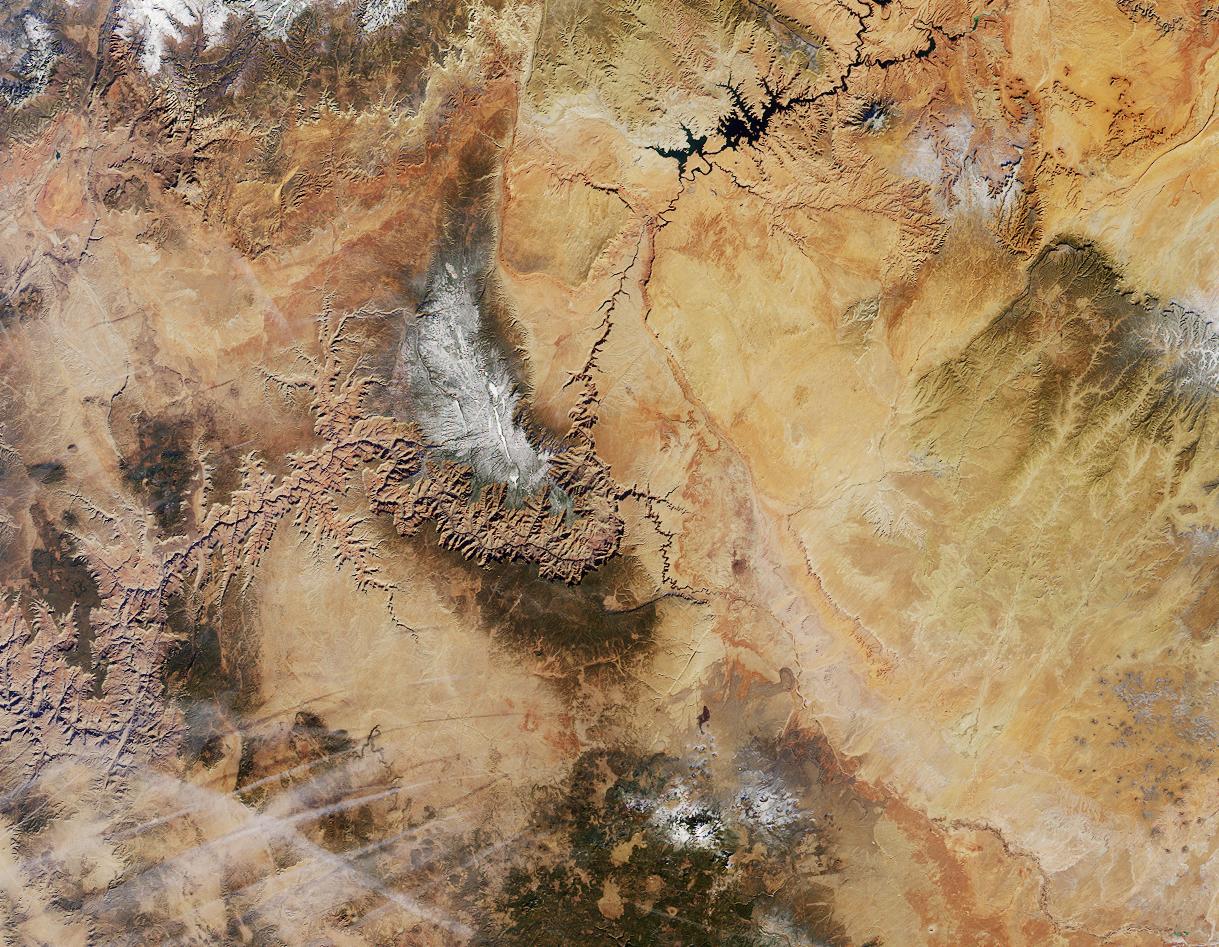
English: A satellite image of the Grand Canyon.
Northern Arizona and the Grand Canyon are captured in this pair of Multi-angle Imaging Spectroradiometer (MISR) images from December 31, 2000. The above image is a true color view from the nadir (vertical) camera. A stereo composite image was generated using data from MISR's vertical and 46-degree-forward cameras. Viewing the stereo image in 3-D requires the use of red/blue glasses with the red filter placed over your left eye. To facilitate stereo viewing, the images have been oriented with north at the left. In addition to the Grand Canyon itself, which is visible in the western (lower) half of the images, other landmarks include Lake Powell, on the left, and Humphreys Peak and Sunset Crater National Monument on the right. Meteor Crater appears as a small dark depression with a brighter rim, and is just visible along the upper right-hand edge. Can you find it? (NOTE: The image in this wiki has been rotated relative to the one on the NASA site, so the preceding description's references to "left", etc., are incorrect.) |
| Date | Unknown date |
| Source | http://earthobservatory.nasa.gov/Newsroom/NewImages/Images/PIA03402_rgb.jpg linked from http://earthobservatory.nasa.gov/Newsroom/NewImages/images.php3?img_id=4808 |
| Author | NASA/GSFC/LaRC/JPL, MISR Team |
Licensing edit
| This file is in the public domain in the United States because it was solely created by NASA. NASA copyright policy states that "NASA material is not protected by copyright unless noted". (See Template:PD-USGov, NASA copyright policy page or JPL Image Use Policy.) | ||
 |
Warnings:
|
File history
Click on a date/time to view the file as it appeared at that time.
| Date/Time | Thumbnail | Dimensions | User | Comment | |
|---|---|---|---|---|---|
| current | 00:06, 20 December 2005 | | 1,219 × 947 (299 KB) | Carnildo (talk | contribs) | Rotated image 90 degrees so north is up |
| 05:33, 27 October 2005 |  | 947 × 1,219 (914 KB) | Ævar Arnfjörð Bjarmason (talk | contribs) | A satellite image of the Grand Canyon. == Original caption == Northern Arizona and the Grand Canyon are captured in this pair of Multi-angle Imaging Spectroradiometer (MISR) images from December 31, 2000. The above image is a t |
You cannot overwrite this file.
File usage on Commons
There are no pages that use this file.
File usage on other wikis
The following other wikis use this file:
- Usage on cs.wikipedia.org
- Usage on zh.wikipedia.org