File:Saxon, Mississippi tornado damage.jpg
Size of this preview: 800 × 600 pixels. Other resolutions: 320 × 240 pixels | 640 × 480 pixels | 1,024 × 768 pixels | 1,280 × 960 pixels.
Original file (1,280 × 960 pixels, file size: 898 KB, MIME type: image/jpeg)
Captions
Captions
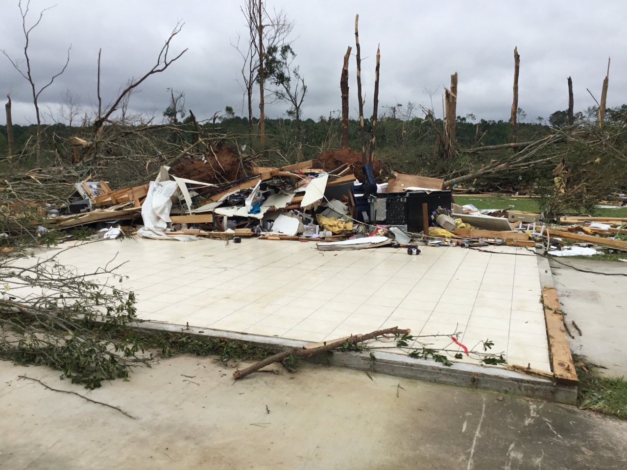
EF4 tornado damage to home southwest of Saxon, Mississippi.
Summary
edit
| Description |
English: A home that was completely destroyed by the EF4 tornado southwest of Saxon, Mississippi. |
| Date | |
| Source | https://services.dat.noaa.gov/arcgis/rest/services/nws_damageassessmenttoolkit/DamageViewer/FeatureServer/0/2092018/attachments/1308326 |
| Author | NWS Jackson |
Licensing
edit
This file is in the public domain in the United States because it was solely created by employees of the National Weather Service or National Severe Storms Laboratory using the Damage Assessment Toolkit (DAT), an interactive map and database.
|
File history
Click on a date/time to view the file as it appeared at that time.
| Date/Time | Thumbnail | Dimensions | User | Comment | |
|---|---|---|---|---|---|
| current | 03:24, 25 March 2021 | | 1,280 × 960 (898 KB) | ChessEric (talk | contribs) | Uploaded a work by NWS Jackson from https://services.dat.noaa.gov/arcgis/rest/services/nws_damageassessmenttoolkit/DamageViewer/FeatureServer/0/2092018/attachments/1308326 with UploadWizard |
You cannot overwrite this file.
File usage on Commons
There are no pages that use this file.
File usage on other wikis
The following other wikis use this file:
- Usage on en.wikipedia.org
- Usage on zh.wikipedia.org